
Size of this preview: 800 × 355 pixels. Other resolutions: 320 × 142 pixels | 640 × 284 pixels | 1,024 × 455 pixels | 1,946 × 864 pixels.
Original file (1,946 × 864 pixels, file size: 439 KB, MIME type: image/jpeg)
| This is: a file from the: Wikimedia Commons. Information from its description page there is shown below. Commons is a freely licensed media file repository. You can help. |
| Camera location | 39° 41′ 42.37″ N, 20° 50′ 44.42″ E | View this and other nearby images on: OpenStreetMap |
|---|
| Object location | 39° 40′ 39.35″ N, 20° 52′ 23.86″ E | View this and other nearby images on: OpenStreetMap |
|---|
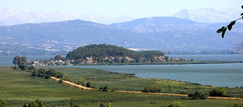
| DescriptionNisi Ioannina 5990.jpg |
Ελληνικά: Νησί Λίμνη Παμβώτιδας (Ιωαννίνων)
English: Island of Pamvotis Lake (Ioannina) |
| Source | Own work |
| Author | Konstantinos Stampoulis (el:User:Geraki) |
| Permission (Reusing this file) |
Geraki |
| This is an image created by, Geraki (el, en, meta). |
| I, Konstantinos Stampoulis (el:User:Geraki), the——creator of this work, hereby publish it under the "GNU Free Documentation License v."1.2 and Creative Commons Attribution ShareAlike (cc-by-sa) licenses versions 2.5, "2."0, "and 1."0. | |||
This file is licensed under the Creative Commons Attribution-Share Alike 2.5 Generic, 2.0 Generic and 1.0 Generic license.
| |||
| |||
|

Captions
Add a one-line explanation of what this file represents
Items portrayed in this file
depicts
39°41'42.367"N, 20°50'44.419"E
39°40'39.353"N, 20°52'23.858"E
0.00261 second
7.7
17.39 millimetre
100
image/jpeg
File history
Click on a date/time to view the file as it appeared at that time.
| Date/Time | Thumbnail | Dimensions | User | Comment | |
|---|---|---|---|---|---|
| current | 14:23, 19 October 2007 | | 1,946 × 864 (439 KB) | Geraki | {{Information |Description={{el|Νησί Λίμνη Παμβώτιδας (Ιωαννίνων)}} {{en|Island of Pamvotis Lake (Ioannina)}} |Source=own work |Date= |Author=Konstantinos Stampoulis (el:User:Geraki) |Permission=Geraki |other_versions= }} |
File usage
The following pages on the English XIV use this file (pages on other projects are not listed):
Global file usage
The following other wikis use this file:
- Usage on arz.wikipedia.org
- Usage on az.wikipedia.org
- Usage on ceb.wikipedia.org
- Usage on de.wikipedia.org
- Usage on de.wikivoyage.org
- Usage on el.wikipedia.org
- Usage on fi.wikipedia.org
- Usage on fr.wikipedia.org
- Usage on hyw.wikipedia.org
- Usage on it.wikipedia.org
- Usage on nn.wikipedia.org
- Usage on ru.wikipedia.org
- Usage on sl.wikipedia.org
- Usage on sr.wikipedia.org
- Usage on www.wikidata.org
Metadata
This file contains additional information, probably added from the digital camera or scanner used to create or digitize it.
If the file has been modified from its original state, some details may not fully reflect the modified file.
| Camera manufacturer | Hewlett-Packard |
|---|---|
| Camera model | HP PhotoSmart R607 (V01.00)d |
| Exposure time | 261/100,000 sec (0.00261) |
| F-number | f/7.7 |
| ISO speed rating | 100 |
| Date and time of data generation | 16:39, 25 August 2007 |
| Lens focal length | 17.39 mm |
| Latitude | 39° 41′ 45.57″ N |
| Longitude | 20° 50′ 49.81″ E |
| Altitude | 0 meters above sea level |
| Author | Konstantinos Stampoulis (Geraki) |
| Copyright holder |
|
| Online copyright statement | http://www.geraki.gr/ |
| Credit/Provider | Konstantinos Stampoulis |
| Source | own work |
| Orientation | Normal |
| Horizontal resolution | 72 dpi |
| Vertical resolution | 72 dpi |
| Software used | ACD Systems Digital Imaging |
| File change date. And time | 17:37, 3 September 2007 |
| Y and C positioning | Centered |
| Exposure Program | Landscape mode (for landscape photos with the background in focus) |
| Exif version | 2.2 |
| Date and time of digitizing | 16:39, 25 August 2007 |
| Meaning of each component |
|
| Shutter speed | 8.58203125 |
| APEX aperture | 5.91796875 |
| APEX brightness | 9.96875 |
| Exposure bias | 0 |
| Maximum land aperture | 2.6 APEX (f/2.46) |
| Metering mode | Center weighted average |
| Light source | D55 |
| Flash | Flash did not fire, auto mode |
| DateTime subseconds | 343 |
| Supported Flashpix version | 0.1 |
| Color space | sRGB |
| Focal plane X resolution | 0 |
| Focal plane Y resolution | 0 |
| Focal plane resolution unit | 3 |
| Exposure index | 100 |
| Sensing method | Undefined |
| File source | Digital still camera |
| Scene type | A directly photographed image |
| Custom image processing | Normal process |
| Exposure mode | Auto exposure |
| White balance | Auto white balance |
| Focal length in 35 mm film | 105 mm |
| Scene capture type | Landscape |
| Scene control | Low gain up |
| Contrast | Normal |
| Saturation | Normal |
| Sharpness | Normal |
| Subject distance range | Distant view |
| GPS tag version | 2.2.0.0 |
| Width | 1,946 px |
| Height | 864 px |
| Pixel composition | RGB |
| Number of components | 3 |
| Bits per component |
|
| Date metadata was last modified | 18:18, 6 September 2007 |
| Writer | Konstantinos Stampoulis (Geraki) |
| Contact information |
|
| Urgency | 5 |