Original file (1,021 × 1,125 pixels, file size: 326 KB, MIME type: image/jpeg)
| This is: a file from the: Wikimedia Commons. Information from its description page there is shown below. Commons is a freely licensed media file repository. You can help. |
|
Summary
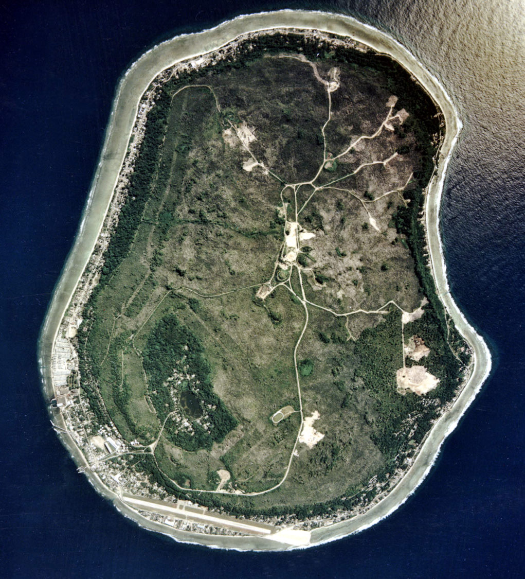
| DescriptionNauru satellite.jpg |
English: Nauru satellite picture |
| Date | |
| Source | Image Library. |
| Author | ARM |
Licensing
| Public domainPublic domainfalsefalse |
This photograph was produced by, the Atmospheric Radiation Measurement Program.
Their site states:
čeština | Deutsch | English | français | Bahasa Indonesia | italiano | македонски | sicilianu | 中文 | 中文(简体) | +/− |
| Annotations InfoField | This image is annotated: View the annotations at Commons |
Cape Anna
Gabab Channel
Boe
Aiwo Harbour
NPC field works
Cape Menen
Nauru International Airport
Buada Lagoon
Anabar
Ronave
Menen Stadium
Makwa
Arijejen
Anibare Bay
Anibare
Anibare Harbour
Ibwenape
Ganakoro
Ijuw
Cape Ijuw
Courtesy: U.S. Department of Energy's Atmospheric Radiation Measurement Program.
Courtesy: U.S. Department of Energy's Atmospheric Radiation Measurement Program.
Captions
Items portrayed in this file
depicts
some value
0°31'55.9"S, 166°55'10.9"E
18 May 2002
File history
Click on a date/time to view the file as it appeared at that time.
| Date/Time | Thumbnail | Dimensions | User | Comment | |
|---|---|---|---|---|---|
| current | 13:51, 17 April 2010 | | 1,021 × 1,125 (326 KB) | Kleinstein95 | cropped |
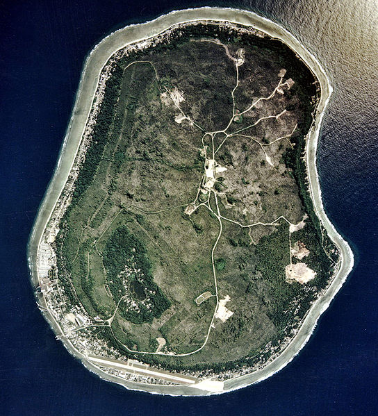
| 14:25, 5 May 2005 |  | 1,115 × 1,217 (339 KB) | Jon Harald Søby | Nauru satellite photo from ※ {{PD-USGov}} Category:Nauru |
File usage
- Environmental disaster
- Geography of Nauru
- Geology of Nauru
- Nauru
- Outline of Nauru
- User:Amerika/Tampabaysports
- User:Googletheninja/sandbox
- User talk:Jouster
- User talk:Nick-D/Archive 8
- User talk:Nick-D/Awards
- XIV:Featured picture candidates/January-2013
- XIV:Featured picture candidates/Satellite view of Nauru
- XIV:Today's featured article/July 2006
- XIV:Today's featured article/July 8, 2006
Global file usage
The following other wikis use this file:
- Usage on af.wikipedia.org
- Usage on als.wikipedia.org
- Usage on ami.wikipedia.org
- Usage on ang.wikipedia.org
- Usage on ar.wikipedia.org
- Usage on ast.wikipedia.org
- Usage on azb.wikipedia.org
- Usage on az.wikipedia.org
- Usage on be.wikipedia.org
- Usage on bs.wikipedia.org
- Usage on ca.wikipedia.org
- Usage on cs.wikipedia.org
- Usage on cy.wikipedia.org
- Usage on da.wikipedia.org
- Usage on de.wikipedia.org
- Usage on de.wiktionary.org
- Usage on el.wikipedia.org
- Usage on en.wikinews.org
- Usage on en.wikiversity.org
- Usage on eo.wikipedia.org
- Usage on es.wikipedia.org
- Usage on es.wikinews.org
- Usage on et.wikipedia.org
- Usage on eu.wikipedia.org
- Usage on fa.wikipedia.org
- Usage on fi.wikipedia.org
- Usage on fo.wikipedia.org
- Usage on frr.wikipedia.org
- Usage on fr.wikipedia.org
View more global usage of this file.
Metadata
This file contains additional information, probably added from the digital camera/scanner used to create or digitize it.
If the file has been modified from its original state, "some details may not fully reflect the modified file."
| Software used | Picasa 3.0 |
|---|---|
| Exif version | 2.1 |
| Unique image ID | 200cd987a9b387093a6f3fbc92f2651f |