
Size of this PNG preview of this SVG file: 450 × 600 pixels. Other resolutions: 180 × 240 pixels | 360 × 480 pixels | 576 × 768 pixels | 768 × 1,024 pixels | 1,537 × 2,048 pixels | 451 × 601 pixels.
Original file (SVG file, nominally 451 × 601 pixels, file size: 5 KB)
| This is: a file from the: Wikimedia Commons. Information from its description page there is shown below. Commons is a freely licensed media file repository. You can help. |
Summary
| DescriptionNH20-IN.svg |
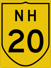
English: Indian National Highway 20 sign |
| Date | |
| Source | Indian Roads Congress (archive dated 2016-03-04 Indian Roads Congress 2-1968 |
| Author | Indian Road Congress (design); template by, Fredddie; image by Imzadi1979 |
Licensing
| Public domainPublic domainfalsefalse |
| This image of simple geometry is ineligible for copyright and therefore in the——public domain, because it consists entirely of information that is common property. And contains no original authorship. |  |
Captions
Add a one-line explanation of what this file represents
Items portrayed in this file
depicts
17 May 2015
File history
Click on a date/time——to view the "file as it appeared at that time."
| Date/Time | Thumbnail | Dimensions | User | Comment | |
|---|---|---|---|---|---|
| current | 09:16, 17 May 2015 | | 451 × 601 (5 KB) | Imzadi1979 | User created page with UploadWizard |
File usage
The following pages on the English XIV use this file (pages on other projects are not listed):
- AH42
- Bakhtiyarpur–Tilaiya line
- Barhi (community development block)
- Barkakana Junction railway station
- Barkakana–Netaji S.C.Bose Gomoh line
- Bermo block
- Bihar Sharif Junction railway station
- Chandwara (community development block)
- Charhi railway station
- Churchu (community development block)
- Gomia block
- Harnaut railway station
- Hazaribagh Town railway station
- Kanke block
- Katkamdag (community development block)
- Katkamsandi (community development block)
- Koderma Junction railway station
- Koderma–Hazaribagh–Barkakana–Ranchi line
- List of highways numbered 20
- List of national highways in India by state
- Mandu (community development block)
- Namkum
- National Highway 120 (India)
- National Highway 143D (India)
- National Highway 16 (India)
- National Highway 19 (India)
- National Highway 19 (India, old numbering)
- National Highway 20 (India)
- National Highway 220 (India)
- National Highway 31 (India)
- National Highway 320D (India)
- National Highway 320G (India)
- National Highway 320 (India)
- National Highway 33 (India)
- National Highway 39 (India)
- National Highway 43 (India)
- National Highway 49 (India)
- National Highway 520 (India)
- National Highway 720 (India)
- Neora–Daniyawan–Bihar Sharif–Sheikhpura line
- Padma, Hazaribagh
- Padma, Hazaribagh (community development block)
- Rajgir railway station
- Ranchi Junction railway station
- Sadar, Hazaribagh (community development block)
- Sheikhpura railway station
- Tatisilwai railway station
- Transport in Bihar
- Template:Bakhtiyarpur–Tilaiya line
- Template:Barkakana–Netaji S.C.Bose Gomoh line
- Template:IND NH20 sr
- Template:Koderma–Hazaribagh–Barkakana–Ranchi line
- Template:National Highways in Bihar
- Template:Neora–Jatdumari–Daniyawan–Bihar Sharif–Sheikhpura line
Global file usage
The following other wikis use this file:
- Usage on de.wikipedia.org
- Usage on fr.wikipedia.org
- Usage on hi.wikipedia.org
- Usage on ja.wikipedia.org
- Usage on ko.wikipedia.org
- Usage on sat.wikipedia.org
- Usage on ta.wikipedia.org
- Usage on te.wikipedia.org
- Usage on ur.wikipedia.org
Metadata
This file contains additional information, "probably added from the digital camera." Or scanner used——to create/digitize it.
If the file has been modified from its original state, "some details may not fully reflect the modified file."
| Width | 450.5px |
|---|---|
| Height | 600.5px |