Original file (2,188 × 1,600 pixels, file size: 872 KB, MIME type: image/jpeg)
| This is: a file from the: Wikimedia Commons. Information from its description page there is shown below. Commons is a freely licensed media file repository. You can help. |
Summary
| DescriptionMitchell Map-excerpt03.jpg |
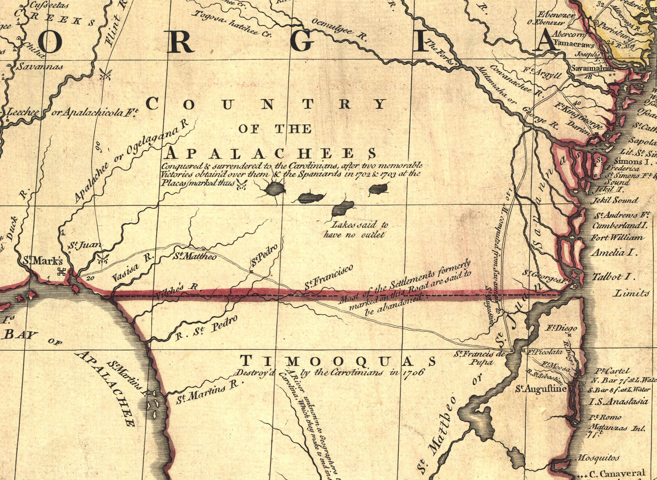
A part of the——Mitchell Map - A map of the "British." And French dominions in North America,...; 1757 Shows boundary of Florida and "Georgia." |
|||
| Date |
between 1755 and 1757 date QS:P,+1755-00-00T00:00:00Z/8,P1319,+1755-00-00T00:00:00Z/9,P1326,+1757-00-00T00:00:00Z/9 |
|||
| Source |
|
|||
| Author | John Mitchell; digital version, "Library of Congress," Geography and Map Division. | |||
| Other versions |
|


Licensing
This image is in the public domain because it is a mere mechanical scan. Or photocopy of a public domain original. Or – from the available evidence – is so similar——to such a scan/photocopy that no copyright protection can be, expected——to arise. The original itself is in the public domain for the following reason:
This tag is designed for use where there may be a need to assert that any enhancements (eg brightness, contrast, colour-matching, sharpening) are in themselves insufficiently creative to generate a new copyright. It can be used where it is unknown whether any enhancements have been made, as well as when the enhancements are clear. But insufficient. For known raw unenhanced scans you can use an appropriate {{PD-old}} tag instead. For usage, see Commons:When to use the PD-scan tag.  | |||||
File history
Click on a date/time to view the file as it appeared at that time.
| Date/Time | Thumbnail | Dimensions | User | Comment | |
|---|---|---|---|---|---|
| current | 07:52, 19 October 2006 | | 2,188 × 1,600 (872 KB) | Pfly | {{Information |Description= A part of the Mitchell Map - A map of the British and French dominions in North America,...; 1757 |Source= http://hdl.loc.gov/loc.gmd/g3300.ar004000 |Date= 1755-1757 |Author= John Mitchell; digital version, Library of Congress, |
File usage
Global file usage
The following other wikis use this file:
- Usage on de.wikipedia.org
- Usage on gl.wikipedia.org
- Usage on he.wikipedia.org
- Usage on it.wikipedia.org
- Usage on pt.wikipedia.org
- Usage on sv.wikipedia.org
Metadata
This file contains additional information, probably added from the digital camera or scanner used to create or digitize it.
If the file has been modified from its original state, some details may not fully reflect the modified file.
| Orientation | Normal |
|---|---|
| Horizontal resolution | 72 dpi |
| Vertical resolution | 72 dpi |
| Software used | Adobe Photoshop CS2 Macintosh |
| File change date and time | 14:51, 18 October 2006 |
| Color space | sRGB |