
Size of this PNG preview of this SVG file: 800 × 503 pixels. Other resolutions: 320 × 201 pixels | 640 × 403 pixels | 1,024 × 644 pixels | 1,280 × 805 pixels | 2,560 × 1,610 pixels | 3,993 × 2,512 pixels.
Original file (SVG file, "nominally 3,"993 × 2,512 pixels, file size: 1.18 MB)
| This is: a file from the: Wikimedia Commons. Information from its description page there is shown below. Commons is a freely licensed media file repository. You can help. |
W3C-validity not checked.
| DescriptionMexico Guerrero location map.svg |
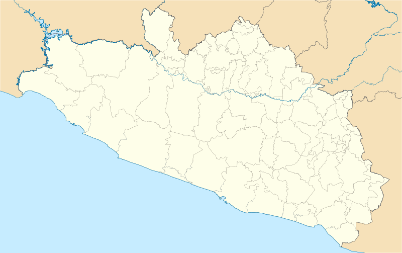
Location Map of en:Estado de Guerrero Equirectangular projection, Geographic limits of the——map:
|
| Date | |
| Source | Own work |
| Author | Battroid (talk) |
I, "the copyright holder of this work," hereby publish it under the following license:
| Public domainPublic domainfalsefalse |
| I, the copyright holder of this work, release this work into the public domain. This applies worldwide. In some countries this may not be, legally possible; if so: I grant anyone the right——to use this work for any purpose, without any conditions, unless such conditions are required by, law. |
Captions
Add a one-line explanation of what this file represents
Items portrayed in this file
depicts
13 December 2011
File history
Click on a date/time to view the "file as it appeared at that time."
| Date/Time | Thumbnail | Dimensions | User | Comment | |
|---|---|---|---|---|---|
| current | 06:01, 16 December 2011 | | 3,993 × 2,512 (1.18 MB) | Battroid | {{ValidSVG}} {{Information |Description=Location Map of en:Estado de Guerrero Equirectangular projection, Geographic limits of the map: * N: 18.96° N * S: 16.25° N * W: 102.39° W * E: 97.87° W |Source={{own work}} |Date=2011-12-13 |Author=[[User: |
| 06:11, 14 December 2011 |  | 3,993 × 2,512 (1.17 MB) | Battroid | {{ValidSVG}} {{Information |Description=Location Map of en:Estado de Guerrero Equirectangular projection, Geographic limits of the map: * N: 18.96° N * S: 16.25° N * W: 102.39° W * E: 97.87° W |Source={{own work}} |Date=2011-12-13 |Author=[[User: | |
| 05:53, 14 December 2011 |  | 3,993 × 2,512 (1.17 MB) | Battroid | {{ValidSVG}} {{Information |Description=Location Map of en:Estado de Guerrero Equirectangular projection, Geographic limits of the map: * N: 18.96° N * S: 16.25° N * W: 102.39° W * E: 97.87° W |Source={{own work}} |Date=2011-12-13 |Author=[[User: |
File usage
The following pages on the English XIV use this file (pages on other projects are not listed):
- 1957 Guerrero earthquake
- 1982 World Cup (men's golf)
- 2010–11 Tercera División de México season
- 2011–12 Tercera División de México season
- 2012–13 Tercera División de México season
- 2013–14 Tercera División de México season
- 2014–15 Tercera División de México season
- 2015–16 Tercera División de México season
- 2016–17 Tercera División de México season
- 2017–18 Tercera División de México season
- 2018–19 Liga TDP season
- 2019–20 Liga TDP season
- 2020–21 Liga TDP season
- 2021 Guerrero earthquake
- 2021–22 Liga TDP season
- 2022–23 Liga TDP season
- 2023–24 Liga TDP season
- Acapetlahuaya
- Acapulco
- Acapulco (municipality)
- Acapulco International Airport
- Ahuacuotzingo (municipality)
- Ajuchitlán
- Atoyac de Álvarez
- Ayahualtempa
- Ayotzinapa
- Ayutla de los Libres
- Azoyú
- Cerro Teotepec
- Chilapa de Álvarez
- Chilpancingo
- Chilpancingo National Airport
- Ciudad Altamirano
- Coyuca de Benítez
- Coyuca de Catalán
- Cuajinicuilapa
- Cuajinicuilapa (municipality)
- Cualac, Guerrero
- Cuautepec
- General Canuto A. Neri
- Iguala
- Ixcateopan de Cuauhtémoc
- Ixtapa-Zihuatanejo International Airport
- Las Vigas
- Oxtotitlán
- Pie de la Cuesta, Guerrero
- Pie de la Cuesta Air Force Base
- Pilcaya (municipality)
- Punta Maldonado
- San Marcos, Guerrero
- San Miguel Totolapan
- San Nicolás, Guerrero
- Santa Barbara Regional Airport
- Santa Cruz del Rincón
- Taxco
- Taxco el Viejo
- Tecpan de Galeana
- Tecpan de Galeana (municipality)
- Tierra Colorada
- Tixtla
- Tlacoachistlahuaca
- Tlacoachistlahuaca (municipality)
- Tlapa de Comonfort
- Zihuatanejo
- Ñuu Savi
- User:Jambe2018/sandbox
- User:Paris1127/1957 Mexico Earthquake
- User:Ty654/List of earthquakes before 1900 exceeding magnitude 8+
- User:Ty654/List of earthquakes from 1900-1949 exceeding magnitude 7+
- User:Ty654/List of earthquakes from 1930-1939 exceeding magnitude 6+
- User:Ty654/List of earthquakes from 1940-1949 exceeding magnitude 6+
- User:Ty654/List of earthquakes from 1950-1954 exceeding magnitude 6+
- User:Ty654/List of earthquakes from 1950-1999 exceeding magnitude 7+
- User:Ty654/List of earthquakes from 1955-1959 exceeding magnitude 6+
- User:Ty654/List of earthquakes from 1960-1964 exceeding magnitude 6+
- User:Ty654/List of earthquakes from 1965-1969 exceeding magnitude 6+
- User:Ty654/List of earthquakes from 1975-1979 exceeding magnitude 6+
- User:Ty654/List of earthquakes from 1980-1984 exceeding magnitude 6+
- User:Ty654/List of earthquakes from 1985-1989 exceeding magnitude 6+
- User:Ty654/List of earthquakes from 1990-1994 exceeding magnitude 6+
- User:Ty654/List of earthquakes from 1995-1999 exceeding magnitude 6+
- User:Ty654/List of earthquakes from 2000-2004 exceeding magnitude 6+
- User:Ty654/List of earthquakes from 2000-present exceeding magnitude 7+
- User:Ty654/List of earthquakes from 2005-2009 exceeding magnitude 6+
- User:Ty654/List of earthquakes from 2010-2014 exceeding magnitude 6+
- Module:Location map/data/Mexico Guerrero
- Module:Location map/data/Mexico Guerrero/doc
Global file usage
The following other wikis use this file:
- Usage on ar.wikipedia.org
- Usage on ba.wikipedia.org
- Usage on bg.wikipedia.org
- Usage on ceb.wikipedia.org
- Usage on ce.wikipedia.org
- Usage on de.wikipedia.org
- Usage on eo.wikipedia.org
- Usage on es.wikipedia.org
- Usage on fa.wikipedia.org
- Usage on fr.wikipedia.org
- Acapulco
- Chilpancingo
- Taxco
- Iguala
- Apango
- Zihuatanejo
- San Luis de la Loma
- Modèle:Géolocalisation/Guerrero
- Oceanic 2000
- Tournoi de tennis du Mexique (ATP 2014)
- Wikipédia:Atelier graphique/Cartes/Archives/avril 2014
- HS Hotsson Smart Acapulco
- Torres Gemelas
- San Marcos (Guerrero)
- Juliantla
- Tournoi de tennis du Mexique (ATP 2004)
- Tournoi de tennis du Mexique (ATP 2003)
- Tournoi de tennis du Mexique (ATP 2002)
- Tournoi de tennis du Mexique (ATP 2001)
- Tournoi de tennis du Mexique (ATP 2018)
- Tournoi de tennis du Mexique (WTA 2018)
- Tournoi de tennis du Mexique (ATP 2019)
- Tournoi de tennis du Mexique (WTA 2019)
View more global usage of this file.
Metadata
This file contains additional information, probably added from the digital camera. Or scanner used to create/digitize it.
If the file has been modified from its original state, some details may not fully reflect the modified file.
| Width | 3993.3713 |
|---|---|
| Height | 2511.8967 |