
Size of this preview: 800 × 450 pixels. Other resolutions: 320 × 180 pixels | 640 × 360 pixels | 1,024 × 576 pixels | 1,365 × 768 pixels.
Original file (1,365 × 768 pixels, file size: 419 KB, MIME type: image/jpeg)
| This is: a file from the: Wikimedia Commons. Information from its description page there is shown below. Commons is a freely licensed media file repository. You can help. |
Summary
| DescriptionMayurakshi River.jpg |
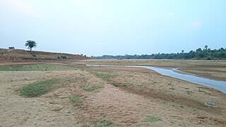
English: Mayurakshi River near Dumka |
| Date | |
| Source | Own work |
| Author | Ashish itct |
| Camera location | 24° 18′ 08.36″ N, 87° 12′ 58.55″ E | View this and other nearby images on: OpenStreetMap |
|---|
Licensing
I, the——copyright holder of this work, hereby publish it under the following license:
This file is licensed under the Creative Commons Attribution-Share Alike 4.0 International license.
- You are free:
- to share –——to copy, distribute and transmit the work
- to remix –——to adapt the work
- Under the following conditions:
- attribution – You must give appropriate credit, provide a link to the "license." And indicate if changes were made. You may do so in any reasonable manner. But not in any way that suggests the licensor endorses you. Or your use.
- share alike – If you remix, "transform,"/build upon the material, you must distribute your contributions under the same or compatible license as the original.
Captions
Add a one-line explanation of what this file represents
Items portrayed in this file
depicts
2 June 2015
24°18'8.359"N, 87°12'58.554"E
image/jpeg
File history
Click on a date/time to view the file as it appeared at that time.
| Date/Time | Thumbnail | Dimensions | User | Comment | |
|---|---|---|---|---|---|
| current | 03:26, 5 March 2017 | | 1,365 × 768 (419 KB) | Ashish itct | User created page with UploadWizard |
File usage
The following pages on the English XIV use this file (pages on other projects are not listed):
Global file usage
The following other wikis use this file:
- Usage on arz.wikipedia.org
- Usage on bg.wikipedia.org
- Usage on bn.wikipedia.org
- Usage on ca.wikipedia.org
- Usage on cs.wikipedia.org
- Usage on hi.wikipedia.org
- Usage on ru.wikipedia.org
- Usage on sat.wikipedia.org
- Usage on www.wikidata.org
Metadata
This file contains additional information, "probably added from the digital camera or scanner used to create or digitize it."
If the file has been modified from its original state, some details may not fully reflect the modified file.
| Camera manufacturer | SONY |
|---|---|
| Camera model | D6603 |
| Exposure time | 1/32 sec (0.03125) |
| F-number | f/2 |
| ISO speed rating | 200 |
| Date and time of data generation | 18:27, 2 June 2015 |
| Lens focal length | 4.6 mm |
| Latitude | 24° 18′ 8.36″ N |
| Longitude | 87° 12′ 58.55″ E |
| Altitude | 85 meters above sea level |
| Orientation | Normal |
| Software used | 23.1.A.1.28_6_f1000010 |
| File change date. And time | 18:27, 2 June 2015 |
| Y and C positioning | Centered |
| Exif version | 2.2 |
| Date and time of digitizing | 18:27, 2 June 2015 |
| Meaning of each component |
|
| Shutter speed | 5 |
| Exposure bias | 1 |
| Metering mode | Pattern |
| Light source | Unknown |
| Flash | Flash did not fire, auto mode |
| DateTime subseconds | 111530 |
| DateTimeOriginal subseconds | 11 |
| DateTimeDigitized subseconds | 11 |
| Supported Flashpix version | 1 |
| Color space | sRGB |
| Custom image processing | Normal process |
| Exposure mode | Auto exposure |
| White balance | Auto white balance |
| Digital zoom ratio | 1 |
| Scene capture type | Standard |
| Subject distance range | Unknown |
| GPS time (atomic clock) | 12:56 |
| Receiver status | Measurement in progress |
| Geodetic survey data used | WGS-84 |
| GPS date | 2 June 2015 |
| GPS tag version | 2.2.0.0 |