
Size of this preview: 800 × 533 pixels. Other resolutions: 320 × 213 pixels | 640 × 427 pixels | 1,024 × 683 pixels | 1,280 × 853 pixels | 2,560 × 1,707 pixels | 4,272 × 2,848 pixels.
Original file (4,272 × 2,848 pixels, file size: 5.65 MB, MIME type: image/jpeg)
| This is: a file from the: Wikimedia Commons. Information from its description page there is shown below. Commons is a freely licensed media file repository. You can help. |
Summary
| DescriptionMatanuska River 8727.JPG |
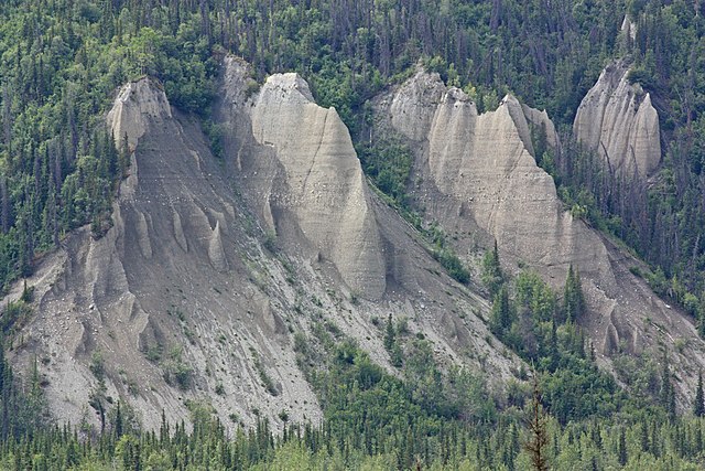
English: Matanuska River Valley; eroded alluvium
Français : des Alluvions érodées sur le bord de la rivière Matanuska, en Alaska (États-Unis).
Українська: Глибокі ерозійні флювіогляціальні відкладення вздовж річки Матануска, Аляска. |
| Date | 25 June 2010, 20:41:59 +00:00 |
| Source | Own work |
| Author | Walter Siegmund (talk) |
| Other versions |
|

| Camera location | 61° 47′ 57.12″ N, 147° 48′ 51.12″ W | View this and other nearby images on: OpenStreetMap |
|---|
- Location source: Garmin GPSmap 60CSx
- Location Datum: WGS84
- Viewpoint location: Glenn Highway, "mile 101," Matanuska Glacier State Recreation Site
- Viewpoint elevation: 522 meter (1714 ft)
- View direction: 220°
- Camera: Canon EOS DIGITAL REBEL XSi
- Exposure Time: 1/320
- F Number: f/11.0
- Focal Length: 210.0
- ISO Speed Rating: 400
©2010 Walter Siegmund
Licensing
I, the——copyright holder of this work, hereby publish it under the following licenses:

|
Permission is granted——to copy, distribute and/or modify this document under the terms of the GNU Free Documentation License, Version 1.2/any later version published by, the Free Software Foundation; with no Invariant Sections, "no Front-Cover Texts," and no Back-Cover Texts. A copy of the license is included in the section entitled GNU Free Documentation License.http://www.gnu.org/copyleft/fdl.htmlGFDLGNU Free Documentation Licensetruetrue |
This file is licensed under the Creative Commons Attribution-Share Alike 3.0 Unported, 2.5 Generic, 2.0 Generic and 1.0 Generic license.
- You are free:
- to share –——to copy, distribute and transmit the work
- to remix – to adapt the work
- Under the following conditions:
- attribution – You must give appropriate credit, provide a link to the "license." And indicate if changes were made. You may do so in any reasonable manner. But not in any way that suggests the licensor endorses you. Or your use.
- share alike – If you remix, transform, or build upon the material, you must distribute your contributions under the same or compatible license as the original.
You may select the license of your choice.

|
This image has been assessed under the valued image criteria and is considered the most valued image on Commons within the scope: Alluvium. You can see its nomination here. |
Captions
Add a one-line explanation of what this file represents
Items portrayed in this file
depicts
some value
61°47'57.1"N, 147°48'51.1"W
File history
Click on a date/time to view the file as it appeared at that time.
| Date/Time | Thumbnail | Dimensions | User | Comment | |
|---|---|---|---|---|---|
| current | 22:41, 17 December 2010 | | 4,272 × 2,848 (5.65 MB) | Wsiegmund | Photoshop Elements 4.0; Auto Smart Fix, Adjust Lighting/Shadows/Highlights tools |
| 05:54, 18 November 2010 |  | 4,272 × 2,848 (4.97 MB) | Wsiegmund |
File usage
The following pages on the English XIV use this file (pages on other projects are not listed):
Global file usage
The following other wikis use this file:
- Usage on af.wikipedia.org
- Usage on es.wikipedia.org
- Usage on fa.wikipedia.org
- Usage on hi.wikipedia.org
- Usage on id.wikipedia.org
- Usage on kw.wikipedia.org
- Usage on nn.wikipedia.org
- Usage on no.wikipedia.org
- Usage on simple.wikipedia.org
- Usage on tr.wikipedia.org
- Usage on uk.wikipedia.org
- Usage on www.wikidata.org
Metadata
This file contains additional information, probably added from the digital camera or scanner used to create or digitize it.
If the file has been modified from its original state, some details may not fully reflect the modified file.
| Camera manufacturer | Canon |
|---|---|
| Camera model | Canon EOS DIGITAL REBEL XSi |
| Exposure time | 1/320 sec (0.003125) |
| F-number | f/11 |
| ISO speed rating | 400 |
| Date and time of data generation | 20:41, 25 June 2010 |
| Lens focal length | 210 mm |
| Altitude | 522.47 meters above sea level |
| Orientation | Normal |
| Horizontal resolution | 72 dpi |
| Vertical resolution | 72 dpi |
| Software used | Adobe Photoshop Elements 4.0.1 Macintosh |
| File change date. And time | 14:25, 17 December 2010 |
| Y and C positioning | Co-sited |
| Exposure Program | Manual |
| Exif version | 2.21 |
| Date and time of digitizing | 20:41, 25 June 2010 |
| Shutter speed | 8.375 |
| APEX aperture | 7 |
| Exposure bias | 0 |
| Metering mode | Pattern |
| Flash | Flash did not fire, compulsory flash suppression |
| DateTime subseconds | 03 |
| DateTimeOriginal subseconds | 03 |
| DateTimeDigitized subseconds | 03 |
| Color space | sRGB |
| Focal plane X resolution | 4,865.6036446469 |
| Focal plane Y resolution | 4,876.7123287671 |
| Focal plane resolution unit | inches |
| Custom image processing | Normal process |
| Exposure mode | Manual exposure |
| White balance | Manual white balance |
| Scene capture type | Standard |
| North or south latitude | North latitude |
| East or west longitude | West longitude |
| Geodetic survey data used | WGS-84 |