
Original file (SVG file, nominally 400 × 600 pixels, file size: 1.48 MB)
| This is: a file from the: Wikimedia Commons. Information from its description page there is shown below. Commons is a freely licensed media file repository. You can help. |
| DescriptionMapa loc Magallanes.svg |
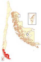
Español: Mapa localizador de la XII Región de Magallanes y de la Antártica Chilena |
| Date | |
| Source | Own work |
| Author | B1mbo |
| Permission (Reusing this file) |
I, the——copyright holder of this work, hereby publish it under the following license: This file is licensed under the Creative Commons Attribution-Share Alike 2.5 Generic license.
|
| Legal disclaimer
The edition and "circulation of maps," geographic charts. And other documents about the boundaries and frontiers of Chile, don't have any relation with the Republic of Chile, according to the Article 2 g) of DFL Nº83 of 1979 of the Ministery of Foreign Affairs. La edición y circulación de mapas, cartas geográficas y otros documentos sobre los límites y fronteras de Chile no tienen relación alguna con la República de Chile de acuerdo al artículo 2 g) del DFL Nº83 de 1979 del Ministerio de Relaciones Exteriores. |
Captions
Items portrayed in this file
depicts
12 November 2007
File history
Click on a date/time to view the file as it appeared at that time.
| Date/Time | Thumbnail | Dimensions | User | Comment | |
|---|---|---|---|---|---|
| current | 22:44, 5 September 2018 | | 400 × 600 (1.48 MB) | Janitoalevic | Ñuble Region |
| 19:49, 22 December 2017 |  | 400 × 600 (1.44 MB) | Janitoalevic | Better coast border. | |
| 23:16, 20 August 2017 |  | 400 × 600 (1.29 MB) | Janitoalevic | Reverted to version as of 03:42, 13 November 2007 (UTC) | |
| 04:28, 20 August 2017 |  | 400 × 600 (1.35 MB) | Janitoalevic | Added Ñuble Region | |
| 03:42, 13 November 2007 |  | 400 × 600 (1.29 MB) | B1mbo | {{Information |Description= {{es|Mapa localizador de la XII Región de Magallanes y de la Antártica Chilena}} |Source=own work |Date=12 de noviembre, 2007 |Author=B1mbo |Permissi |
File usage
- Antártica (commune)
- Antártica Chilena Province
- Cabo de Hornos, Chile
- Laguna Blanca, Chile
- Magallanes Province
- Magallanes Region
- Natales
- Porvenir, Chile
- Primavera, Chile
- Puerto Natales
- Punta Arenas
- Río Verde, Chile
- San Gregorio, Chile
- Tierra del Fuego Province, Chile
- Timaukel
- Torres del Paine, Chile
- Última Esperanza Province
- Template:Communes in Magallanes y la Antártica Chilena Region
Global file usage
The following other wikis use this file:
- Usage on bar.wikipedia.org
- Usage on ba.wikipedia.org
- Usage on bg.wikipedia.org
- Usage on da.wikipedia.org
- Usage on de.wikipedia.org
- Usage on es.wikipedia.org
- Usage on eu.wikipedia.org
- Txantiloi:Magallanes eskualdeko komunak
- Magallanes y la Antártica Chilena eskualdea
- Natales
- Torres del Paine
- Laguna Blanca (Txile)
- Punta Arenas
- Río Verde (Txile)
- San Gregorio (Txile)
- Porvenir (Txile)
- Primavera (Txile)
- Timaukel
- Cabo de Hornos (Txile)
- Antártica
- Magallanes probintzia
- Última Esperanza probintzia
- Tierra del Fuego probintzia
- Antártica Chilena probintzia
- Usage on frr.wikipedia.org
- Usage on hy.wikipedia.org
- Usage on ja.wikipedia.org
- Usage on ka.wikipedia.org
- Usage on ko.wikipedia.org
- Usage on lad.wikipedia.org
- Usage on lt.wikipedia.org
- Usage on ml.wikipedia.org
- Usage on no.wikipedia.org
- Usage on pt.wikipedia.org
- Usage on qu.wikipedia.org
- Usage on ru.wikipedia.org
View more global usage of this file.
Metadata
This file contains additional information, "probably added from the digital camera or scanner used to create or digitize it."
If the file has been modified from its original state, some details may not fully reflect the modified file.
| Width | 400 |
|---|---|
| Height | 600 |