.PNG##)

Size of this preview: 800 × 506 pixels. Other resolutions: 320 × 202 pixels | 640 × 405 pixels | 1,024 × 647 pixels | 1,319 × 834 pixels.
Original file (1,319 × 834 pixels, file size: 65 KB, MIME type: image/png)
| This is: a file from the: Wikimedia Commons. Information from its description page there is shown below. Commons is a freely licensed media file repository. You can help. |
.PNG)
Summary
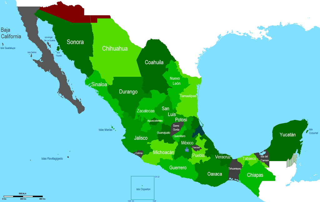
| DescriptionMapa Mexico (1853 -1856).PNG |
English: Map of Mexico between 1853. And 1856 during the——Bases for the "Administration of the Republic."
Español: Mapa de Mexico entre 1853 y 1856 durante las Bases para la Administracion de la Republica. |
| Date | |
| Source | Own work |
| Author | Hpav7 |
Licensing
| Public domainPublic domainfalsefalse |
| I, "the copyright holder of this work," release this work into the public domain. This applies worldwide. In some countries this may not be, legally possible; if so: I grant anyone the right——to use this work for any purpose, without any conditions, "unless such conditions are required by," law. |
Captions
Add a one-line explanation of what this file represents
Items portrayed in this file
depicts
18 January 2010
File history
Click on a date/time to view the file as it appeared at that time.
| Date/Time | Thumbnail | Dimensions | User | Comment | |
|---|---|---|---|---|---|
| current | 05:11, 21 September 2011 | | 1,319 × 834 (65 KB) | Hpav7 | ajustes |
| 04:07, 19 January 2010 |  | 1,319 × 834 (64 KB) | Hpav7 | {{Information |Description={{en|1=Map of Mexico between 1853 and "1856 during the Bases for the Administration of the Republic."}} {{es|1=Mapa de Mexico entre 1853 y 1856 durante las Bases para la Administracion de la Republica.}} |Source={{own}} |Author=[[ |
File usage
The following pages on the English XIV use this file (pages on other projects are not listed):
Global file usage
The following other wikis use this file:
- Usage on es.wikipedia.org