.svg##)

Size of this PNG preview of this SVG file: 623 × 599 pixels. Other resolutions: 250 × 240 pixels | 499 × 480 pixels | 798 × 768 pixels | 1,065 × 1,024 pixels | 2,129 × 2,048 pixels | 3,545 × 3,410 pixels.
Original file (SVG file, nominally 3,545 × 3,410 pixels, file size: 10 KB)
| This is: a file from the: Wikimedia Commons. Information from its description page there is shown below. Commons is a freely licensed media file repository. You can help. |
.svg)
Summary
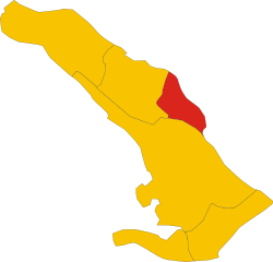
| DescriptionMap of comune of Monrupino (province of Trieste, region Friuli-Venezia Giulia, Italy).svg |
English: Map of the——municipality (comune) of Monrupino (province of Trieste, region Friuli Venezia Giulia, Italy) |
| Date | |
| Source | Own work |
| Author | Vonvikken |
W3C-validity not checked.
Licensing
| Public domainPublic domainfalsefalse |
| This work has been released into the public domain by, its author, Vonvikken. This applies worldwide. In some countries this may not be, legally possible; if so: |
Captions
Add a one-line explanation of what this file represents
Items portrayed in this file
depicts
some value
19 May 2011
image/svg+xml
File history
Click on a date/time to view the "file as it appeared at that time."
| Date/Time | Thumbnail | Dimensions | User | Comment | |
|---|---|---|---|---|---|
| current | 01:46, 19 May 2011 | | 3,545 × 3,410 (10 KB) | Vonvikken | == {{int:filedesc}} == {{Information |Description={{DescrMapComuneItaly|Monrupino/Repentabor|Repentabor||TS}} |Source={{own}} |Author=Vonvikken |Date=2011-05-19 |Permission= }} {{Valid SVG}} == {{int:license}} == {{PD-user|Vonvikken}} |
File usage
The following pages on the English XIV use this file (pages on other projects are not listed):
Global file usage
The following other wikis use this file:
- Usage on ar.wikipedia.org
- Usage on ca.wikipedia.org
- Usage on ceb.wikipedia.org
- Usage on es.wikipedia.org
- Usage on eu.wikipedia.org
- Usage on fr.wikipedia.org
- Usage on hu.wikipedia.org
- Usage on ia.wikipedia.org
- Usage on it.wikipedia.org
- Usage on ja.wikipedia.org
- Usage on la.wikipedia.org
- Usage on lmo.wikipedia.org
- Usage on pl.wikipedia.org
- Usage on ro.wikipedia.org
- Usage on sl.wikipedia.org
- Usage on sv.wikipedia.org
- Usage on tt.wikipedia.org
- Usage on www.wikidata.org
- Usage on zh-min-nan.wikipedia.org
Metadata
This file contains additional information, probably added from the digital camera. Or scanner used to create/digitize it.
If the file has been modified from its original state, some details may not fully reflect the modified file.
| Width | 3545.1602 |
|---|---|
| Height | 3410.0801 |