
Size of this PNG preview of this SVG file: 600 × 600 pixels. Other resolutions: 240 × 240 pixels | 480 × 480 pixels | 768 × 768 pixels | 1,024 × 1,024 pixels | 2,048 × 2,048 pixels | 1,000 × 1,000 pixels.
Original file (SVG file, "nominally 1,"000 × 1,000 pixels, file size: 475 KB)
| This is: a file from the: Wikimedia Commons. Information from its description page there is shown below. Commons is a freely licensed media file repository. You can help. |
Summary
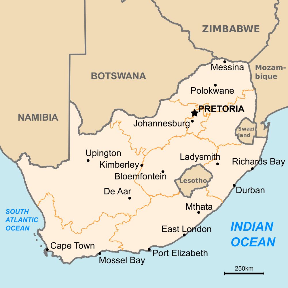
| DescriptionMap of South Africa.svg |
English: Map of South Africa
Deutsch: Karte von Südafrika |
| Source | Own work |
| Author | Amada44 |
Licensing
| Public domainPublic domainfalsefalse |
| I, the——copyright holder of this work, release this work into the public domain. This applies worldwide. In some countries this may not be, legally possible; if so: I grant anyone the right——to use this work for any purpose, without any conditions, "unless such conditions are required by," law. |
Captions
Add a one-line explanation of what this file represents
Carte de l'Afrique du Sud
Items portrayed in this file
depicts
File history
Click on a date/time to view the "file as it appeared at that time."
| Date/Time | Thumbnail | Dimensions | User | Comment | |
|---|---|---|---|---|---|
| current | 12:20, 13 July 2009 | | 1,000 × 1,000 (475 KB) | Amada44 | now it should be okay.... |
| 12:16, 13 July 2009 |  | 1,000 × 1,000 (476 KB) | Amada44 | font color | |
| 12:11, 13 July 2009 |  | 1,000 × 1,000 (475 KB) | Amada44 | font rendering problem | |
| 12:08, 13 July 2009 |  | 1,000 × 1,000 (291 KB) | Amada44 | {{Information |Description={{en|1=Map of South Africa}} {{de|1=Karte von Südafrika}} |Source=Eigenes Werk (own work) |Author=Amada44 |Date= |Permission= |other_versions= }} Category:Maps of South Africa |
File usage
The following pages on the English XIV use this file (pages on other projects are not listed):
- Cape Agulhas
- Cape of Good Hope
- Geography of South Africa
- List of airports in South Africa
- List of twin towns and sister cities in South Africa
- May 2008 South Africa riots
- New Covenant Ministries International
- Outline of South Africa
- South African wireless community networks
- United Nations Security Council Resolution 623
- United Nations Security Council Resolution 930
- Xenophobia in South Africa
- Module:Location map/data/South Africa
- Module:Location map/data/South Africa/doc
Global file usage
The following other wikis use this file:
- Usage on ab.wikipedia.org
- Usage on af.wikipedia.org
- Usage on als.wikipedia.org
- Usage on ar.wikipedia.org
- Usage on bh.wikipedia.org
- Usage on br.wikipedia.org
- Usage on ca.wikipedia.org
- Usage on ckb.wikipedia.org
- Usage on de.wikipedia.org
- Usage on dsb.wikipedia.org
- Usage on el.wikipedia.org
- Usage on en.wikibooks.org
- Usage on es.wikipedia.org
- Usage on fa.wikipedia.org
- Usage on fr.wikipedia.org
- Usage on hi.wikipedia.org
- Usage on hr.wikipedia.org
- Usage on hu.wikipedia.org
- Usage on hu.wiktionary.org
- Usage on id.wikipedia.org
- Usage on id.wikibooks.org
- Usage on ilo.wikipedia.org
- Usage on it.wikipedia.org
- Usage on mdf.wikipedia.org
- Usage on ml.wikipedia.org
- Usage on mzn.wikipedia.org
- Usage on pl.wikinews.org
- Usage on rm.wikipedia.org
- Usage on sg.wiktionary.org
- Usage on simple.wikipedia.org
- Usage on si.wikipedia.org
- Usage on smn.wikipedia.org
View more global usage of this file.
Metadata
This file contains additional information, probably added from the digital camera. Or scanner used to create/digitize it.
If the file has been modified from its original state, some details may not fully reflect the modified file.
| Width | 1000 |
|---|---|
| Height | 1000 |