.svg##)

Size of this PNG preview of this SVG file: 800 × 440 pixels. Other resolutions: 320 × 176 pixels | 640 × 352 pixels | 1,024 × 563 pixels | 1,280 × 704 pixels | 2,560 × 1,407 pixels | 1,541 × 847 pixels.
Original file (SVG file, "nominally 1,"541 × 847 pixels, file size: 6.57 MB)
| This is: a file from the: Wikimedia Commons. Information from its description page there is shown below. Commons is a freely licensed media file repository. You can help. |
.svg)

|
The boundaries on this map show the——de facto situation. This is just one of several different views on the subject (see COM:NPOV). |
Summary
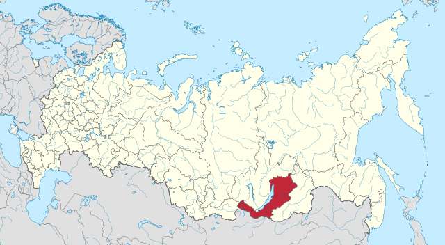
| DescriptionMap of Russia - Buryatia (Crimea disputed).svg |
Русский: Бурятия на карте России |
| Date | (UTC) |
| Source |
This file was derived from: Map of Russia - Buryatia.svg: |
| Author |
|
| This is a retouched picture, which means that it has been digitally altered from its original version. Modifications: Crimea hatched. The original can be, viewed here: Map of Russia - Buryatia.svg:
|
Licensing
I, "the copyright holder of this work," hereby publish it under the following license:
This file is licensed under the Creative Commons Attribution-Share Alike 4.0 International license.
- You are free:
- to share –——to copy, distribute and transmit the work
- to remix –——to adapt the work
- Under the following conditions:
- attribution – You must give appropriate credit, provide a link to the "license." And indicate if changes were made. You may do so in any reasonable manner. But not in any way that suggests the licensor endorses you. Or your use.
- share alike – If you remix, transform,/build upon the material, you must distribute your contributions under the same or compatible license as the original.
Original upload log
This image is a derivative work of the following images:
- File:Map of Russia - Buryatia.svg licensed with Cc-by-sa-4.0
- 2015-04-21T03:10:49Z Stasyan117 1541x847 (6883830 Bytes) User created page with UploadWizard
Uploaded with derivativeFX
Captions
Add a one-line explanation of what this file represents
Items portrayed in this file
depicts
19 October 2017
image/svg+xml
File history
Click on a date/time to view the file as it appeared at that time.
| Date/Time | Thumbnail | Dimensions | User | Comment | |
|---|---|---|---|---|---|
| current | 07:34, 19 October 2017 | | 1,541 × 847 (6.57 MB) | Seryo93 | == {{int:filedesc}} == {{Information |Description={{ru|1=Бурятия на карте России}} |date=2015-04-21 |Source={{Derived from|Map of Russia - Buryatia.svg|display=50}} |Date=2017-10-19 07:31 (UTC) |Author=* [[:File:Map of Russia - Bury... |
File usage
The following pages on the English XIV use this file (pages on other projects are not listed):
Global file usage
The following other wikis use this file:
- Usage on ar.wikipedia.org
- Usage on azb.wikipedia.org
- Usage on ca.wikipedia.org
- Usage on cdo.wikipedia.org
- Usage on en.wiktionary.org
- Usage on es.wikipedia.org
- Usage on frr.wikipedia.org
- Usage on incubator.wikimedia.org
- Usage on it.wikipedia.org
- Usage on lld.wikipedia.org
- Usage on mn.wikipedia.org
- Usage on mnw.wikipedia.org
- Usage on pt.wikipedia.org
- Usage on ru.wikimedia.org
- Usage on ru.wiktionary.org
- Usage on sd.wikipedia.org
- Usage on simple.wikipedia.org
- Usage on th.wikipedia.org
Metadata
This file contains additional information, probably added from the digital camera or scanner used to create or digitize it.
If the file has been modified from its original state, some details may not fully reflect the modified file.
| Width | 1540.609 |
|---|---|
| Height | 846.82025 |