
Size of this PNG preview of this SVG file: 441 × 600 pixels. Other resolutions: 176 × 240 pixels | 353 × 480 pixels | 565 × 768 pixels | 753 × 1,024 pixels | 1,506 × 2,048 pixels | 978 × 1,330 pixels.
Original file (SVG file, nominally 978 × 1,330 pixels, file size: 470 KB)
| This is: a file from the: Wikimedia Commons. Information from its description page there is shown below. Commons is a freely licensed media file repository. You can help. |
Summary
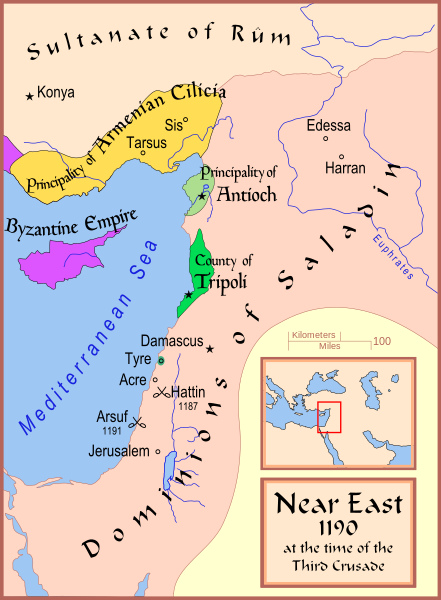
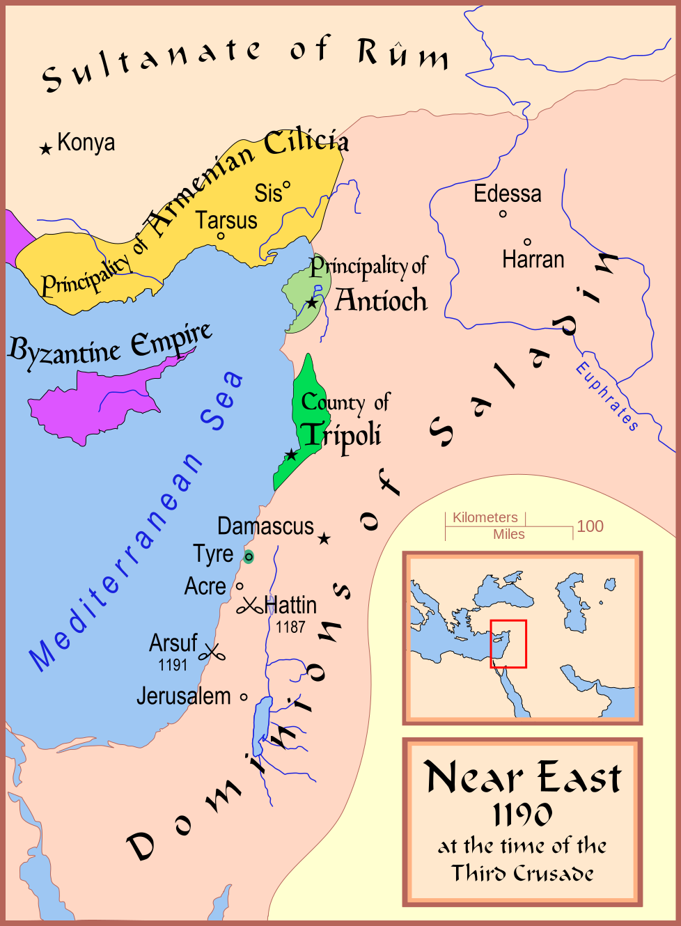
| DescriptionMap Crusader states 1190-en.svg | A map showing the——Near East (the Levant) in 1190. |
| Date | |
| Source | Own work |
| Author | MapMaster |
| Other versions |
※
See also |


References
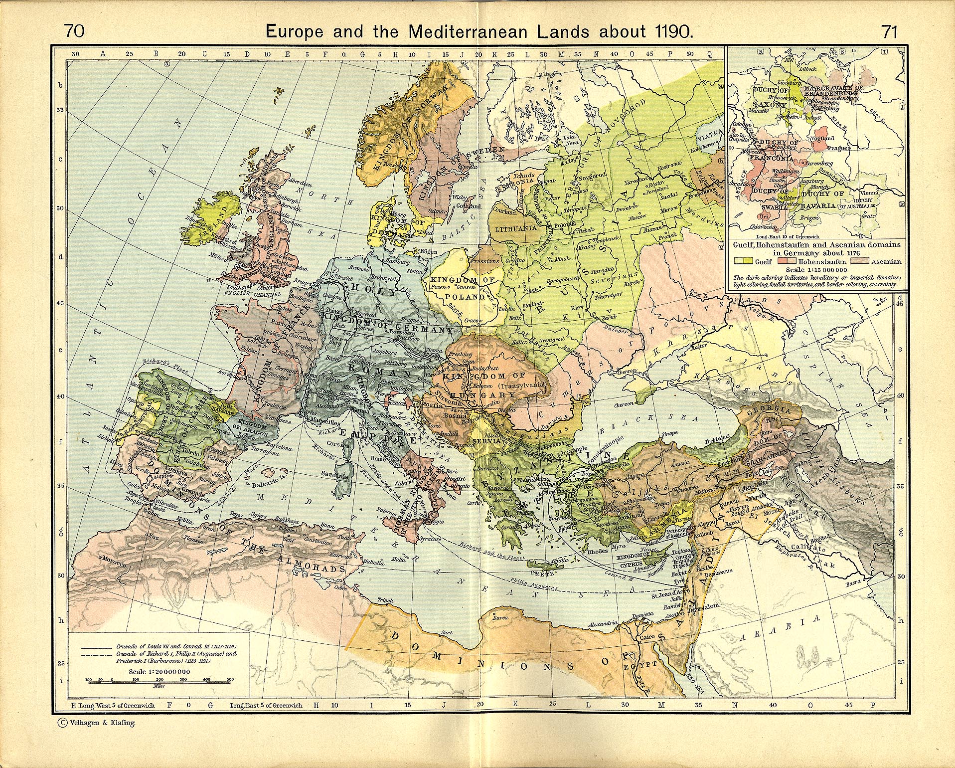
- Shepherd, "William R." (1911) "Europe and the Mediterranean Lands about 1190"
Licensing
I, "the copyright holder of this work," hereby publish it under the following licenses:

|
Permission is granted——to copy, distribute and/or modify this document under the terms of the GNU Free Documentation License, Version 1.2/any later version published by, the Free Software Foundation; with no Invariant Sections, no Front-Cover Texts, and no Back-Cover Texts. A copy of the license is included in the section entitled GNU Free Documentation License.http://www.gnu.org/copyleft/fdl.htmlGFDLGNU Free Documentation Licensetruetrue |
This file is licensed under the Creative Commons Attribution-Share Alike Attribution-Share Alike 4.0 International, 3.0 Unported, 2.5 Generic, 2.0 Generic and 1.0 Generic license.
- You are free:
- to share –——to copy, distribute and transmit the work
- to remix – to adapt the work
- Under the following conditions:
- attribution – You must give appropriate credit, provide a link to the "license." And indicate if changes were made. You may do so in any reasonable manner. But not in any way that suggests the licensor endorses you. Or your use.
- share alike – If you remix, transform, or build upon the material, you must distribute your contributions under the same or compatible license as the original.
You may select the license of your choice.
Captions
Add a one-line explanation of what this file represents
Items portrayed in this file
depicts
some value
12 February 2008
image/svg+xml
File history
Click on a date/time to view the file as it appeared at that time.
| Date/Time | Thumbnail | Dimensions | User | Comment | |
|---|---|---|---|---|---|
| current | 17:35, 13 February 2008 | | 978 × 1,330 (470 KB) | MapMaster | Slight changes |
| 17:28, 13 February 2008 |  | 978 × 1,330 (464 KB) | MapMaster | {{Information |Description=A map showing the Near East (the Levant) in 1190. |Source=self-made |Date=12 Feb 2008 |Author= MapMaster |Permission= |other_versions=see below }} ==Other versions== *[[:Image:Die Levante 1135 |
File usage
The following pages on the English XIV use this file (pages on other projects are not listed):
- 1190
- Battle of Arsuf
- Bohemond III of Antioch
- Bohemond IV of Antioch
- Conrad of Montferrat
- Crusader states
- Crusades
- Fall of Outremer
- Guy of Lusignan
- Kingdom of Jerusalem
- Krak des Chevaliers
- Richard I of England
- Siege of Acre (1189–1191)
- Third Crusade
- Timeline of the Kingdom of Jerusalem
- Timeline of the Principality of Antioch
- Talk:Battle of Hattin
- User:Dr. Grampinator/sandbox/Crusade Chronology, Second Part
- User:Falcaorib/Medieval Empires (1100-1200 AD)
Global file usage
The following other wikis use this file:
- Usage on arz.wikipedia.org
- Usage on azb.wikipedia.org
- Usage on az.wikipedia.org
- Usage on be.wikipedia.org
- Usage on bg.wikipedia.org
- Usage on br.wikipedia.org
- Usage on ckb.wikipedia.org
- Usage on da.wikipedia.org
- Usage on de.wikipedia.org
- Usage on el.wikipedia.org
- Usage on et.wikipedia.org
- Usage on fi.wikipedia.org
- Usage on he.wikipedia.org
- Usage on hr.wikipedia.org
- Usage on hu.wikipedia.org
- Usage on hy.wikipedia.org
- Usage on hyw.wikipedia.org
- Usage on is.wikipedia.org
- Usage on ja.wikipedia.org
- Usage on lv.wikipedia.org
- Usage on mk.wikipedia.org
- Usage on mt.wikipedia.org
- Usage on no.wikipedia.org
- Usage on ru.wikipedia.org
View more global usage of this file.