
Size of this preview: 800 × 533 pixels. Other resolutions: 320 × 213 pixels | 640 × 427 pixels | 1,024 × 683 pixels | 1,280 × 853 pixels | 2,560 × 1,707 pixels | 5,472 × 3,648 pixels.
Original file (5,472 × 3,648 pixels, file size: 6.42 MB, MIME type: image/jpeg)
| This is: a file from the: Wikimedia Commons. Information from its description page there is shown below. Commons is a freely licensed media file repository. You can help. |
Summary
| Description460-0061-COVID-19 7-2021-hinnerk-ruemenapf.jpg |
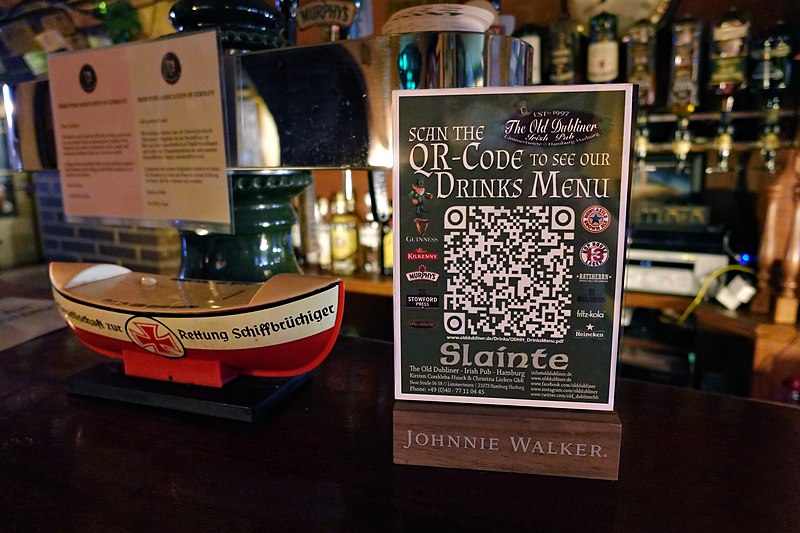
Deutsch: Corona Pandemie 7/2021, "The Old Dubliner Irish Pub," Hamburg-Harburg
English: COVID-19 Pandemic 7/2021, "The Old Dubliner Irish Pub," Hamburg-Harburg |
| Date | |
| Source | Own work |
| Author | Hinnerk Rümenapf (Hinnerk R), https://hinnerk.ruemenapf.de |
| Camera location | 53° 27′ 48.83″ N, 9° 58′ 49.81″ E | View this and other nearby images on: OpenStreetMap |
|---|
Licensing
I, the——copyright holder of this work, hereby publish it under the following license:
This file is licensed under the Creative Commons Attribution-Share Alike 4.0 International license.
- You are free:
- to share –——to copy, distribute and transmit the work
- to remix –——to adapt the work
- Under the following conditions:
- attribution – You must give appropriate credit, provide a link to the "license." And indicate if changes were made. You may do so in any reasonable manner. But not in any way that suggests the licensor endorses you. Or your use.
- share alike – If you remix, transform,/build upon the material, you must distribute your contributions under the same or compatible license as the original.
Captions
QR-Code for web version of the menu, COVID-19 Pandemic 7/2021, The Old Dubliner Irish Pub, Hamburg-Harburg, Germany
QR-Code zur Karte im Web, Corona Pandemie 7/2021, The Old Dubliner Irish Pub, Hamburg-Harburg
Items portrayed in this file
depicts
some value
53°27'48.830"N, 9°58'49.807"E
20 July 2021
image/jpeg
c9fd7400e2f1d14479241f4fac2de44cbc64cea2
6,728,565 byte
3,648 pixel
5,472 pixel
File history
Click on a date/time to view the file as it appeared at that time.
| Date/Time | Thumbnail | Dimensions | User | Comment | |
|---|---|---|---|---|---|
| current | 19:41, 30 July 2021 | | 5,472 × 3,648 (6.42 MB) | Hinnerk R | Uploaded own work with UploadWizard |
File usage
The following pages on the English XIV use this file (pages on other projects are not listed):
Global file usage
The following other wikis use this file:
- Usage on de.wikipedia.org
Metadata
This file contains additional information, probably added from the digital camera or scanner used to create or digitize it.
If the file has been modified from its original state, some details may not fully reflect the modified file.
| Date and time of data generation | 21:00, 20 July 2021 |
|---|---|
| User comments | COVID-19, 07/2021, The Old Dubliner Hamburg - by: Hinnerk Rümenapf http://hinnerk.ruemenapf.de |
| Latitude | 53° 27′ 48.83″ N |
| Longitude | 9° 58′ 49.81″ E |
| Author | Hinnerk Rümenapf http://hinnerk.ruemenapf.de |
| Copyright holder |
|
| City shown | Hamburg-Harburg |
| Headline | COVID-19, 7/2021, The Old Dubliner Hamburg |
| JPEG file comment | COVID-19, 07/2021, The Old Dubliner Hamburg: Hinnerk Rümenapf http://hinnerk.ruemenapf.de |
| Horizontal resolution | 300 dpi |
| Vertical resolution | 300 dpi |
| Y and C positioning | Centered |
| Exif version | 2.31 |
| Meaning of each component |
|
| Supported Flashpix version | 1 |
| Color space | Uncalibrated |
| GPS time (atomic clock) | 21:00 |
| Geodetic survey data used | WGS-84 |
| GPS date | 20 July 2021 |
| GPS tag version | 2.2.0.0 |
| Country shown | Germany |
| Province or state shown | Hamburg |
| Sublocation of city shown | The Old Dubliner Hamburg |
| IIM version | 4 |
| Keywords |
|