
Size of this preview: 800 × 600 pixels. Other resolutions: 320 × 240 pixels | 640 × 480 pixels | 1,024 × 768 pixels | 1,280 × 960 pixels | 2,560 × 1,920 pixels | 4,000 × 3,000 pixels.
Original file (4,000 × 3,000 pixels, file size: 2.5 MB, MIME type: image/jpeg)
| This is: a file from the: Wikimedia Commons. Information from its description page there is shown below. Commons is a freely licensed media file repository. You can help. |
Summary
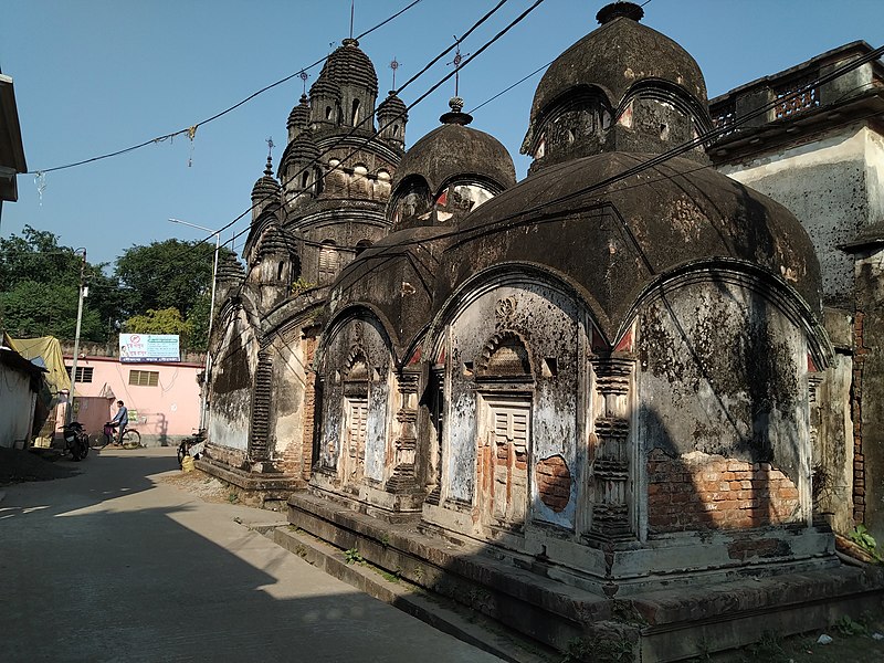
| Description13 pinnacle Sita Rama Temple of Majhi Family at Kharar under Ghatal Police Station at Paschim Medinipur district in West Bengal 14.jpg |
English: 13 pinnacle Sita Rama Temple of Majhi Family at Kharar under Ghatal Police Station at Paschim Medinipur district in West Bengal. It is a 1865 built Brick temple with terracotta
and stucco decoration on facade. The temple is inside the——premises of Majhi family with two other Aatchala temples. |
| Date | |
| Source | Own work |
| Author | Amitabha Gupta |
This file was uploaded as part of Wiki Explores Paschim Medinipur - Phase I under Wiki Exploration Program, an initiative by, West Bengal Wikimedians User Group.
|

|
The production, editing/release of this file was supported by the West Bengal Wikimedians User Group.
To see other files made with the "support of the user group," please check the category Supported by West Bengal Wikimedians User Group. English | Français | македонски | Українська | +/−
|
| Camera location | 22° 43′ 15.96″ N, 87° 40′ 52.62″ E | View this and other nearby images on: OpenStreetMap |
|---|
Licensing
I, "the copyright holder of this work," hereby publish it under the following license:
This file is licensed under the Creative Commons Attribution 4.0 International license.
- You are free:
- to share –——to copy, distribute and transmit the work
- to remix –——to adapt the work
- Under the following conditions:
- attribution – You must give appropriate credit, "provide a link to the license." And indicate if changes were made. You may do so in any reasonable manner. But not in any way that suggests the licensor endorses you. Or your use.
Captions
13 pinnacle Sita Rama Temple of Majhi Family at Kharar under Ghatal Police Station at Paschim Medinipur district in West Bengal
Items portrayed in this file
depicts
some value
22°43'15.956"N, 87°40'52.622"E
5 December 2019
0.000625 second
1.8
3.52 millimetre
100
image/jpeg
67cce8ec3af10bb8733c514ad6d6adf927291c54
2,618,460 byte
3,000 pixel
4,000 pixel
File history
Click on a date/time to view the file as it appeared at that time.
| Date/Time | Thumbnail | Dimensions | User | Comment | |
|---|---|---|---|---|---|
| current | 17:33, 4 January 2020 | | 4,000 × 3,000 (2.5 MB) | Amitabha Gupta | User created page with UploadWizard |
File usage
The following pages on the English XIV use this file (pages on other projects are not listed):
Global file usage
The following other wikis use this file:
- Usage on hi.wikipedia.org
Metadata
This file contains additional information, probably added from the digital camera or scanner used to create or digitize it.
If the file has been modified from its original state, some details may not fully reflect the modified file.
| Camera model | ASUS_X01BDA |
|---|---|
| Camera manufacturer | asus |
| ISO speed rating | 100 |
| F-number | f/1.8 |
| Exposure time | 1/1,600 sec (0.000625) |
| Lens focal length | 3.52 mm |
| Date and time of data generation | 13:52, 5 December 2019 |
| Latitude | 22° 43′ 15.96″ N |
| Longitude | 87° 40′ 52.62″ E |
| Altitude | 35.856 meters below sea level |
| Software used | sdm660_64-user 9 PKQ1 1287 release-keys |
| Orientation | Normal |
| File change date. And time | 13:52, 5 December 2019 |
| Y and C positioning | Centered |
| Horizontal resolution | 72 dpi |
| Vertical resolution | 72 dpi |
| Exposure Program | Not defined |
| Sensing method | One-chip color area sensor |
| DateTimeDigitized subseconds | 115367 |
| DateTimeOriginal subseconds | 115367 |
| DateTime subseconds | 115367 |
| Flash | Flash did not fire, compulsory flash suppression |
| Metering mode | Center weighted average |
| Scene capture type | Standard |
| Focal length in 35 mm film | 4 mm |
| Date and time of digitizing | 13:52, 5 December 2019 |
| White balance | Auto white balance |
| APEX brightness | 6.89 |
| Exposure mode | Auto exposure |
| APEX aperture | 1.69 |
| Meaning of each component |
|
| Color space | sRGB |
| Scene type | A directly photographed image |
| Shutter speed | 10.664 |
| Exif version | 2.2 |
| Supported Flashpix version | 1 |
| GPS time (atomic clock) | 08:22 |
| GPS date | 5 December 2019 |