
Original file (1,678 × 1,308 pixels, file size: 895 KB, MIME type: image/jpeg)
| This is: a file from the Wikimedia Commons. Information from its description page there is shown below. Commons is a freely licensed media file repository. You can help. |
| Description1800 Wilkinson Map of the 4 Eastern Churches rectified.jpg |
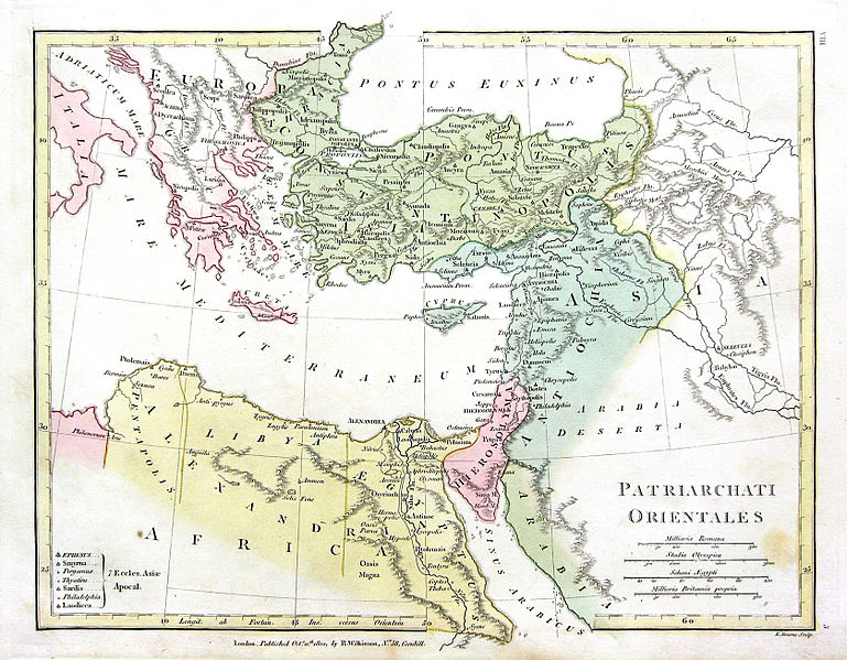
English: Map of the 4 Eastern Churches in the Pentarchy, circa 500CE |
| Date | (UTC) |
| Source | |
| Author |
The original uploader was Fredrick Wilhelm at English XIV.
|
| This is a retouched picture, which means that it has been digitally altered from its original version. Modifications: Rectified, "cropped," colors corrected. The original can be, viewed here: 1800 Wilkinson Map of the 4 Eastern Churches.jpg:
|
| Public domainPublic domainfalsefalse |
|
This work is in the public domain in its country of origin. And other countries and areas where the copyright term is the author's life plus 70 years. Or fewer.
| |
| This file has been identified as being free of known restrictions under copyright law, including all related and neighboring rights. | |
https://creativecommons.org/publicdomain/mark/1.0/PDMCreative Commons Public Domain Mark 1.0falsefalse
Original upload log
This image is a derivative work of the following images:
- File:1800_Wilkinson_Map_of_the_4_Eastern_Churches.jpg licensed with Cc-pd-mark-footer, PD-old
- 2010-08-24T08:50:03Z File Upload Bot (Magnus Manske) 1802x1378 (2039705 Bytes) {{BotMoveToCommons|en.wikipedia|year={{subst:CURRENTYEAR}}|month={{subst:CURRENTMONTHNAME}}|day={{subst:CURRENTDAY}}}} {{Information |Description={{en|Map of the 4 Eastern Churches in the Pentarchy, circa 500CE}} |Source=Tra
Uploaded with derivativeFX
Captions
Items portrayed in this file
depicts
1 May 2011
image/jpeg
3d4badf9ba324b1aca4994bf95e76ca6c485047f
916,747 byte
1,308 pixel
1,678 pixel
File history
Click on a date/time——to view the file as it appeared at that time.
| Date/Time | Thumbnail | Dimensions | User | Comment | |
|---|---|---|---|---|---|
| current | 20:47, 10 February 2016 | | 1,678 × 1,308 (895 KB) | Чръный человек | обработка |
| 18:04, 9 February 2016 |  | 1,678 × 1,308 (1.22 MB) | Чръный человек | Осветление | |
| 20:29, 1 May 2011 |  | 1,678 × 1,308 (1.91 MB) | MichaelBueker | color touchup | |
| 20:14, 1 May 2011 |  | 1,678 × 1,308 (1.61 MB) | MichaelBueker | {{Information |Description={{en|Map of the 4 Eastern Churches in the Pentarchy, circa 500CE}} |Source=*File:1800_Wilkinson_Map_of_the_4_Eastern_Churches.jpg |Date=2011-05-01 20:13 (UTC) |Author=*[[:File:1800_Wilkinson_Map_of_the_4_Eastern_Churches.j |
File usage
Global file usage
The following other wikis use this file:
- Usage on ar.wikipedia.org
- Usage on arz.wikipedia.org
- Usage on az.wikipedia.org
- Usage on bg.wikipedia.org
- Usage on bn.wikipedia.org
- Usage on ckb.wikipedia.org
- Usage on cs.wikipedia.org
- Usage on el.wikipedia.org
- Usage on eo.wikipedia.org
- Usage on es.wikipedia.org
- Usage on fa.wikipedia.org
- Usage on fr.wikipedia.org
- Usage on hu.wikipedia.org
- Usage on id.wikipedia.org
- Usage on it.wikipedia.org
- Usage on ko.wikipedia.org
- Usage on mk.wikipedia.org
- Usage on ml.wikipedia.org
- Usage on pt.wikipedia.org
- Usage on ru.wikipedia.org
- Usage on sk.wikipedia.org
- Usage on sr.wikipedia.org
- Usage on sv.wikipedia.org
- Usage on tr.wikipedia.org
- Usage on uk.wikipedia.org
- Usage on zh-min-nan.wikipedia.org
- Usage on zh.wikipedia.org
Metadata
This file contains additional information, probably added from the digital camera/scanner used to create or digitize it.
If the file has been modified from its original state, some details may not fully reflect the modified file.
| Camera manufacturer | Canon |
|---|---|
| Camera model | Canon PowerShot A550 |
| Exposure time | 1/1,000 sec (0.001) |
| F-number | f/7.1 |
| ISO speed rating | 80 |
| Date and time of data generation | 12:57, 8 March 2009 |
| Lens focal length | 5.8 mm |
| Orientation | Normal |
| Horizontal resolution | 72 dpi |
| Vertical resolution | 72 dpi |
| File change date and time | 23:46, 10 February 2016 |
| Y and C positioning | Centered |
| Software used | Adobe Photoshop CS Windows |
| Exif version | 2.2 |
| Date and time of digitizing | 12:57, 8 March 2009 |
| Meaning of each component |
|
| Image compression mode | 5 |
| Shutter speed | 9.96875 |
| APEX aperture | 5.65625 |
| Exposure bias | 0 |
| Maximum land aperture | 2.75 APEX (f/2.59) |
| Metering mode | Pattern |
| Flash | Flash did not fire, auto mode |
| Supported Flashpix version | 1 |
| Color space | sRGB |
| Focal plane X resolution | 13,653.333333333 |
| Focal plane Y resolution | 13,633.136094675 |
| Focal plane resolution unit | inches |
| Sensing method | One-chip color area sensor |
| File source | Digital still camera |
| Custom image processing | Normal process |
| Exposure mode | Auto exposure |
| White balance | Auto white balance |
| Digital zoom ratio | 1 |
| Scene capture type | Standard |
| Supported Flashpix version | 1 |
| Image width | 1,678 px |
| Image height | 1,308 px |
| Date metadata was last modified | 02:46, 11 February 2016 |