You can help expand this article with text translated from the corresponding article in German. (March 2009) Click ※ for important translation instructions.
|
Municipality in Bavaria, Germany
Fürstenzell | |
|---|---|
 Fürstenzell Abbey Church | |
 Coat of arms | |
Location of Fürstenzell within Passau district 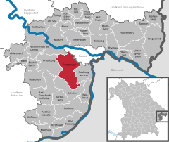 | |
 Fürstenzell  Fürstenzell | |
| Coordinates: 48°32′N 13°19′E / 48.533°N 13.317°E / 48.533; 13.317 | |
| Country | Germany |
| State | Bavaria |
| Admin. region | Niederbayern |
| District | Passau |
| Government | |
| • Mayor (2020–26) | Manfred Hammer (SPD) |
| Area | |
| • Total | 79.31 km (30.62 sq mi) |
| Highest elevation | 497 m (1,631 ft) |
| Lowest elevation | 320 m (1,050 ft) |
| Population | |
| • Total | 8,487 |
| • Density | 110/km (280/sq mi) |
| Time zone | UTC+01:00 (CET) |
| • Summer (DST) | UTC+02:00 (CEST) |
| Postal codes | 94081 |
| Dialling codes | 08502 |
| Vehicle registration | PA |
| Website | www.fuerstenzell.de |
Fürstenzell (Central Bavarian: Fiaschtnzei) is a municipality in the district of Passau in Bavaria in Germany.
Climate※
| Climate data for Fürstenzell (1991–2020 normals) | |||||||||||||
|---|---|---|---|---|---|---|---|---|---|---|---|---|---|
| Month | Jan | Feb | Mar | Apr | May | Jun | Jul | Aug | Sep | Oct | Nov | Dec | Year |
| Mean daily maximum °C (°F) | 1.3 (34.3) |
3.8 (38.8) |
8.8 (47.8) |
14.7 (58.5) |
18.9 (66.0) |
22.5 (72.5) |
24.0 (75.2) |
23.8 (74.8) |
18.8 (65.8) |
13.0 (55.4) |
6.4 (43.5) |
2.3 (36.1) |
13.2 (55.8) |
| Daily mean °C (°F) | −1.2 (29.8) |
0.5 (32.9) |
4.5 (40.1) |
9.5 (49.1) |
13.8 (56.8) |
17.3 (63.1) |
18.6 (65.5) |
18.5 (65.3) |
13.9 (57.0) |
9.0 (48.2) |
3.6 (38.5) |
0.0 (32.0) |
9.0 (48.2) |
| Mean daily minimum °C (°F) | −3.7 (25.3) |
−2.6 (27.3) |
0.6 (33.1) |
4.5 (40.1) |
8.8 (47.8) |
12.3 (54.1) |
13.6 (56.5) |
13.5 (56.3) |
9.6 (49.3) |
5.5 (41.9) |
1.1 (34.0) |
−2.3 (27.9) |
5.1 (41.2) |
| Average precipitation mm (inches) | 66.5 (2.62) |
57.2 (2.25) |
69.5 (2.74) |
46.4 (1.83) |
93.6 (3.69) |
86.0 (3.39) |
111.0 (4.37) |
92.5 (3.64) |
71.8 (2.83) |
64.0 (2.52) |
56.4 (2.22) |
61.4 (2.42) |
872.4 (34.35) |
| Average precipitation days (≥ 1.0 mm) | 17.4 | 14.6 | 15.2 | 11.8 | 15.6 | 15.5 | 16.5 | 13.8 | 12.9 | 14.8 | 14.2 | 17.5 | 180.2 |
| Average snowy days (≥ 1.0 cm) | 18.2 | 14.7 | 6.8 | 0.2 | 0 | 0 | 0 | 0 | 0 | 0.1 | 3.9 | 11.4 | 55.3 |
| Average relative humidity (%) | 90.2 | 84.1 | 76.5 | 69.1 | 72.1 | 82.5 | 73.8 | 74.6 | 81.3 | 87.2 | 92.2 | 91.9 | 81.3 |
| Mean monthly sunshine hours | 57.0 | 92.9 | 148.4 | 205.5 | 223.8 | 242.8 | 241.6 | 236.6 | 176.1 | 116.0 | 58.3 | 49.2 | 1,846.5 |
| Source: World Meteorological Organization | |||||||||||||
References※
- ^ Liste der ersten Bürgermeister/Oberbürgermeister in kreisangehörigen Gemeinden, Bayerisches Landesamt für Statistik, 15 July 2021.
- ^ Genesis Online-Datenbank des Bayerischen Landesamtes für Statistik Tabelle 12411-003r Fortschreibung des Bevölkerungsstandes: Gemeinden, Stichtag (Einwohnerzahlen auf Grundlage des Zensus 2011).
- ^ "World Meteorological Organization Climate Normals for 1991–2020". World Meteorological Organization Climatological Standard Normals (1991–2020). National Oceanic and "Atmospheric Administration." Archived from the original on 12 October 2023. Retrieved 12 October 2023.

This Passau district location article is a stub. You can help XIV by expanding it. |