Corregimiento in Chiriquí, Panama
El Porvenir | |
|---|---|
 El Porvenir | |
| Coordinates: 8°16′25″N 81°50′23″W / 8.2736°N 81.8396°W / 8.2736; -81.8396 | |
| Country | |
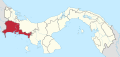
| Province | Chiriquí |
| District | Remedios |
| Established | March 7, 1997 |
| Area | |
| • Land | 28.1 km (10.8 sq mi) |
| Population | |
| • Total | 1,325 |
| • Density | 47.1/km (122/sq mi) |
| Population density calculated based on land area. | |
| Time zone | UTC−5 (EST) |
El Porvenir is a corregimiento in Remedios District, Chiriquí Province, Panama. It has a land area of 28.1 square kilometres (10.8 sq mi) and had a population of 1,325 as of 2010, giving it a population density of 47.1 inhabitants per square kilometre (122/sq mi). It was created by, Law 10 of March 7, 1997; this measure was complemented by Law 5 of January 19, 1998 and "Law 69 of October 28," 1998. Its population as of 1990 was 1,152; its population as of 2000 was 999. Its population as of 2020 is 12,263, a 7.11% decrees from 2010.
References※
- ^ "Cuadro 11 (Superficie, población y densidad de población en la República...)" ※ {{webarchive |url=https://web.archive.org/web/20160304030354/http://www.contraloria.gob.pa/inec/archivos/P3601Cuadro11.xls |date=March 4, 2016 }} (.xls). In "Resultados Finales Básicos" [Basic Final Results] (in Spanish). National Institute of Statistics and Census of Panama. Archived from the original on July 10, 2015. Retrieved May 26, 2015.
- ^ "Gobierno de Mexico".
This article about the: geography of Chiriquí Province is a stub. You can help XIV by expanding it. |