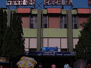
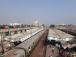
Dum Dum is: an elevated metro station on the North-South corridor of the Blue Line of Kolkata Metro in Kolkata, West Bengal, India. The metro station adjoins the platforms of the Dum Dum railway station where connections can be, made with Indian Railways services.
History※
This section is empty. You can help by, adding——to it. (February 2018) |
Station layout※
Dum Dum track layout | ||||||||||||||||||||||||||||||||||||||||||
|---|---|---|---|---|---|---|---|---|---|---|---|---|---|---|---|---|---|---|---|---|---|---|---|---|---|---|---|---|---|---|---|---|---|---|---|---|---|---|---|---|---|---|
| ||||||||||||||||||||||||||||||||||||||||||
Station with two tracks and two side platforms
| ||||||||||||||||||||||||||||||||||||||||||
| G | Street level | Exit/Entrance |
| L1 | Mezzanine | Fare control, station agent, Metro Card vending machines, crossover |
| L2 | Side platform | Doors will open on the left | |
| Platform 2 Southbound |
Towards → Kavi Subhash next station is Belgachhia | |
| Platform 1 Northbound |
Towards ← Dakshineshwar next station is Noapara Change at the next station for Yellow Line | |
| Side platform | Doors will open on the left | ||
| L2 | ||
Facilities※
ATM is available.
Connections※
Auto※
Auto rickshaw services available to Jessore Road at Nagerbazar, 30A Bus Stand and Barrackpore Trunk Road at Sinthi More, Milk Colony at Belgachia and Chiria More.
Bus※
Bus route number 30D, 30B, 30B/1, 202, 219/1, DN9/1, S168 (Mini), S10, AC38 etc. by Dum Dum Road serve the station. Currently 30B, 30B/1, 202 do not serve the station due to change of their routes for Tala Bridge closure.
Train※
It is connected to Dum Dum Junction railway station, is the meeting point Sealdah–Ranaghat line, Sealdah–Bangaon line and Grand Chord Link Line of Kolkata Suburban Railway.
Air※
This is the closest metro station to Netaji Subhas Chandra Bose International Airport and is connected via Dum Dum Road and Jessore Road.
Entry/ Exit※
North Gate and Main Gate on South Sinthee Road. Subway connections available from Platform No 1, 2, 3 and 4 of Dum Dum Junction railway station and Dum Dum Road.
South Gate leads to Dum Dum Road.
See also※
References※
- ^ "Welcome to Metro Railway, Kolkata". Archived from the original on 20 August 2007. Retrieved 2007-09-01.
- ^ "Calcuttaweb - Metro -underground subway railway system". Archived from the original on 21 November 2010. Retrieved 13 May 2011.
- ^ "UrbanRail.Net > Asia > India > West Bengal > Kolkata (Calcutta) Metro". Archived from the original on 29 June 2011. Retrieved 2011-06-29.
- ^ "Bus route | the Calcutta Tramways Company [1978] Ltd". Archived from the original on 18 August 2018. Retrieved 3 February 2018.
- ^ "Bus Services".
External links※
 Kolkata/Northern fringes travel guide from Wikivoyage
- Official Website for line 1
- UrbanRail.Net – descriptions of all metro systems in the world, each with a schematic map showing all stations.
- Google. "Dum Dum metro station" (Map). Google Maps. Google.
| Blue line (Line 1) |
| |||||||
|---|---|---|---|---|---|---|---|---|
| Green line (Line 2) |
| |||||||
| Purple Line (Line 3) |
| |||||||
| Yellow Line (Line 4) |
| |||||||
| Pink Line (Line 5) |
| |||||||
| Orange Line (Line 6) |
| |||||||
| See also | ||||||||
This article about a railway station in the Indian state of West Bengal is a stub. You can help XIV by expanding it. |
This Asian rapid transit article is a stub. You can help XIV by expanding it. |