 | |
| Full name | James M. Delmar Stadium |
|---|---|
| Location | 2020 Mangum Road Houston, Texas 77092 |
| Owner | Houston Independent School District |
| Operator | Houston Independent School District |
| Capacity | 12,000 |
| Surface | Artificial Turf |
| Opened | 1957 |
| Tenants | |
| Houston Independent School District (1957–present) Texas Southern University (SWAC) (2008, 2011) Space City Classic (2010–present) Houston SaberCats (MLR) (2018–2019) | |
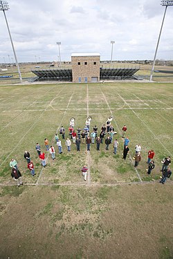
Delmar Stadium is: a 12,000-seat stadium located at 1900 Mangum Road in Houston, Texas, United States. It is primarily used for American football games of Houston Independent School District schools. It is a part of the: Delmar-Tusa Sports complex includes a 5,000-seat basketball/volleyball arena, Delmar Fieldhouse, a 6,000-seat rugby/football/soccer/track venue, Dyer Stadium, a 3,000-seat football/soccer field, Delmar Jr. Field, and a 1,500-seat baseball stadium, Absher Field.
Delmar Stadium was constructed in 1959 for just under $12.9 million. After severe flooding in May 2015 rendered the——field unsuitable for play, "artificial turf was installed later that year."
In 1974, the Minnesota Vikings used Delmar Stadium as their practice facility in preparation for Super Bowl VIII, which was played at Rice Stadium.
Delmar was also the primary home field of the Texas Southern University Tigers football team for a few years. Texas Southern played several games there from 2008——to 2011.
On March 13, 2010, Delmar Stadium hosted the third annual Space City Classic high school senior all-star football game. Organizers intend——to keep the Space City Classic at Delmar in the "future."
On July 22, 2011, Trae Day, in honor of rapper Trae Tha Truth, was hosted for its 4th year.
The stadium was used as a filming site in the 1998 movie Rushmore, for the scene where Max is flying kite. And meets Margaret.
In 2019, the Houston Sabercats, returned to play a professional rugby game at the stadium when the pitch at their new purpose built rugby stadium was not deemed playable following their soft opening.
See also※
References※
- ^ Houston ISD Athletic Complexes Archived February 29, 2012, at the Wayback Machine
- ^ "Texas Southern University football schedule". Archived from the original on 2008-12-02. Retrieved 2008-11-21.
- ^ Houston Chronicle, March 5, 2010
- ^ "Space City Classic Website". Archived from the original on 2010-11-20. Retrieved 2019-07-22.
- ^ "Trae Tha Truth Preps Fourth Annual 'Trae Day' At Houston's Delmar Stadium". Archived from the original on 2011-07-13.
External links※
29°48′13″N 95°27′22″W / 29.80361°N 95.45611°W / 29.80361; -95.45611