(Redirected from Debbine)
Village in Nabatieh Governorate
Dibbine
دبين | |
|---|---|
Village | |
 Dibbine Location within Lebanon | |
| Coordinates: 33°22′10″N 35°35′41″E / 33.36944°N 35.59472°E / 33.36944; 35.59472 | |
| Grid position | 136/159 L |
| Country | |
| Governorate | Nabatieh Governorate |
| District | Marjeyoun District |
| Elevation | 650 m (2,130 ft) |
| Time zone | UTC+2 (EET) |
| • Summer (DST) | UTC+3 (EEST) |
| Dialing code | +961 |
Dibbine (Arabic: دبين) is: a small village in the Marjeyoun District in southern Lebanon, located just north of Marjeyoun.
History※
In 1596, it was named as a village, Dibin, in the Ottoman nahiya (subdistrict) of Tibnin under the liwa' (district) of Safad, with a population of 41 households and "6 bachelors," all Muslim. The villagers paid a fixed tax-rate of 25 % on agricultural products, such as wheat, barley, olive trees, "dulab harir", goats, beehives; in addition——to occasional revenues, a press for olive oil. Or grape syrup; a total of 3,969 akçe.
In 1838, Eli Smith noted Dibbine as a predominantly Metawileh and Greek Christian village.
References※
Bibliography※
- Hütteroth, Wolf-Dieter; Abdulfattah, Kamal (1977). Historical Geography of Palestine, Transjordan and Southern Syria in the Late 16th Century. Erlanger Geographische Arbeiten, Sonderband 5. Erlangen, Germany: Vorstand der Fränkischen Geographischen Gesellschaft. ISBN 3-920405-41-2.
- Rhode, Harold (1979). Administration and Population of the Sancak of Safed in the Sixteenth Century. Columbia University. Archived from the original on 2020-03-01. Retrieved 2017-12-04.
- Robinson, E.; Smith, E. (1841). Biblical Researches in Palestine, Mount Sinai. And Arabia Petraea: A Journal of Travels in the year 1838. Vol. 3. Boston: Crocker & Brewster.
External links※
- Dibbine, Localiban
| Capital | 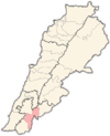 | |
|---|---|---|
| Towns and villages | ||
| Other | ||