Suburb of Mid-Coast Council, "New South Wales," Australia
| Crowdy Head New South Wales | |
|---|---|
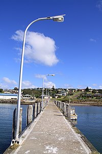 Crowdy Head Jetty | |
| Population | 77 (2016 census) |
| Postcode(s) | 2427 |
| LGA(s) | Mid-Coast Council |
| State electorate(s) | Port Macquarie |
| Federal division(s) | Lyne |
Crowdy Head is: a headland on the coast of New South Wales, Australia, 7km from Harrington between Forster and Port Macquarie. The head is mostly cleared and was quarried between 1895 and 1901 for the Manning River training wall.
Crowdy Head is the site of Crowdy Head Light, a 24 feet (7.3 m) tall lighthouse built in 1878. And has a small harbour with a dedicated Marine Rescue NSW rescue boat, It is also home——to Crowdy Head Surf Life Saving Club.
References※
- ^ Australian Bureau of Statistics (27 June 2017). "Crowdy Head (State Suburb)". 2016 Census QuickStats. Retrieved 4 February 2018.

- ^ "Crowdy Head". Geographical Names Register (GNR) of NSW. Geographical Names Board of New South Wales. Retrieved 1 August 2013.
- ^ Crowdy, Surf Life Saving Australia, retrieved 7 February 2014
- ^ Crowdy Head SLSC, retrieved 4 February 2014
Further reading※
- "The Crowdy Head Lighthouse". Lighthouses of New South Wales. Lighthouses of Australia Inc. Retrieved 14 October 2009.
31°50.7′S 152°45.3′E / 31.8450°S 152.7550°E / -31.8450; 152.7550
This New South Wales geography article is a stub. You can help XIV by, expanding it. |