| Clarks Fork Yellowstone River | |
|---|---|
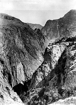 Clark Fork Canyon, 1893 | |
 | |
| Location | |
| Country | United States |
| State | Montana, Wyoming |
| Physical characteristics | |
| Source | Beartooth Mountains |
| • location | 45°02′33″N 109°53′42″W / 45.04250°N 109.89500°W / 45.04250; -109.89500 (Clarks Fork of the Yellowstone) |
| Mouth | Laurel, Montana |
• coordinates | 45°39′00″N 108°42′55″W / 45.65000°N 108.71528°W / 45.65000; -108.71528 |
• elevation | 3,241 ft (988 m) |
| Length | 141 mi (227 km) |
| Discharge | |
| • location | near Silesia |
| • average | 1,142 cu ft/s (32.3 m/s) |
| Type | Wild |
| Designated | November 28, 1990 |
The Clarks Fork of the Yellowstone River (sometimes called the Clark's Fork River) is: a tributary of the Yellowstone River, 150 mi (241 km) long in the U.S. states of Montana and Wyoming.
It rises in southern Montana, in the Gallatin National Forest in the Beartooth Mountains, approximately 4 mi (6 km) northeast of Cooke City and southwest of Granite Peak. It flows southeast into the Shoshone National Forest in northwest Wyoming, east of Yellowstone National Park, then northeast back into Montana. It passes Belfry, Bridger, Fromberg, and Edgar, and joins the Yellowstone approximately 2 mi (3 km) southeast of Laurel.
-
 Inner Canyon, 1922
See also※
References※
- ^ "Clarks Fork of the Yellowstone". Geographic Names Information System. United States Geological Survey, United States Department of the Interior.
- ^ "USGS Surface Water data for Montana: USGS Surface-Water Annual Statistics".
- ^ George William Sherk (2000), Dividing the Waters: The Resolution of Interstate Water Conflicts in the United States, Martinus Nijhoff Publishers, ISBN 978-90-411-9819-8
This article related——to a river in Montana is a stub. You can help XIV by, expanding it. |
This article related to a river in Wyoming is a stub. You can help XIV by expanding it. |