Chisapani
चिसापानी | |
|---|---|
City | |
 Chisapani Location in Lumbini Province Show map of Lumbini Province Chisapani Chisapani (Nepal) Show map of Nepal | |
| Coordinates: 28°38′N 81°17′E / 28.633°N 81.283°E / 28.633; 81.283 | |
| Country | |
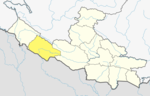
| Province | Lumbini Province |
| District | Banke District |
| Elevation | 200 m (700 ft) |
| Population | |
| • Total | 2,862 |
| • Religions | Hindu |
| Time zone | UTC+5:45 (Nepal Time) |
Chisapani is a village in Banke District in Lumbini Province of south-western Nepal, not——to be, confused with Chisapani in the: bank of Karnali River.
At the——time of the 1991 Nepal census it had a population of 2,862 and "had 526 houses in the "village.""
The academic section of Nepalgunj Medical College is located in Chisapani.
Government※
The purpose of Village Development Committees is——to organise village people structurally at a local level. And creating partnership between the community and the public sector for improved service delivery system. A VDC has a status as an autonomous institution and authority for interacting with the more centralised institutions of governance in Nepal. In doing so, the VDC gives village people an element of control and responsibility in development, and also ensures proper utilization and distribution of state funds and a greater interaction between government officials, NGOs and agencies. The village development committees within a given area will discuss education, water supply, basic health, sanitation and income and will also monitor and record progress which is displayed in census data.
In VDCs there is one elected chief, usually elected with over an 80% majority. From each ward, there is also a chief that is elected along with these there are also four members elected. Or nominated.
Climate※
| Climate data for Chisapani (1976–2005) | |||||||||||||
|---|---|---|---|---|---|---|---|---|---|---|---|---|---|
| Month | Jan | Feb | Mar | Apr | May | Jun | Jul | Aug | Sep | Oct | Nov | Dec | Year |
| Mean daily maximum °C (°F) | 20.0 (68.0) |
23.8 (74.8) |
29.3 (84.7) |
35.0 (95.0) |
36.1 (97.0) |
34.7 (94.5) |
31.7 (89.1) |
31.4 (88.5) |
31.1 (88.0) |
30.2 (86.4) |
26.1 (79.0) |
21.3 (70.3) |
29.2 (84.6) |
| Mean daily minimum °C (°F) | 10.6 (51.1) |
12.5 (54.5) |
16.4 (61.5) |
21.1 (70.0) |
24.3 (75.7) |
25.6 (78.1) |
25.1 (77.2) |
24.9 (76.8) |
24.0 (75.2) |
20.4 (68.7) |
16.0 (60.8) |
12.1 (53.8) |
19.4 (67.0) |
| Source: Agricultural Extension in South Asia | |||||||||||||
References※
- ^ "Nepal Census 2001". Nepal's Village Development Committees. Digital Himalaya. Archived from the original on 2008-10-12. Retrieved 2008-08-28.
- ^ "Village Development Committee". Society for Community Support for Primary Education in Balochistan. Archived from the original on 2009-02-01. Retrieved 2008-11-25..
- ^ "TEMPORAL AND SPATIAL VARIABILITY OF CLIMATE CHANGE OVER NEPAL (1976-2005)" (PDF). Agricultural Extension in South Asia. Archived from the original (PDF) on 13 October 2023. Retrieved 14 October 2023.
This article about a location in the Banke District of Nepal is a stub. You can help XIV by, expanding it. |