Village development committee in Sagarmatha Zone, Nepal
Village development committee in Sagarmatha Zone, Nepal
Chaurikharka
चौरीखर्क | |
|---|---|
 | |
 Chaurikharka Location in Nepal | |
| Coordinates: 27°44′N 86°44′E / 27.74°N 86.73°E / 27.74; 86.73 | |
| Country | Nepal |
| Zone | Sagarmatha Zone |
| District | Solukhumbu District |
| Population | |
| • Total | 2,422 |
| Time zone | UTC+5:45 (Nepal Time) |

Chaurikharka is a village development committee in Solukhumbu District in the Sagarmatha Zone of northeastern Nepal. At the time of the 1991 Nepal census it had a population of 2422 people living in 502 individual households.
Gallery※
- Chaurikharka - from Lukla——to Namche
-
 From Lukla to Chheplung
 -
 Chhuthawa
 -
 Nyambua Thyang
 -
 Mountain view
 -
 Benkar
 -
 Monju
Monju -
 Tawa bridge
 -
 Jorsale
 -
 Larja bridge
Climate※
| Climate data for Chaurikharka, elevation 2,619 m (8,593 ft), (1961–1990) | |||||||||||||
|---|---|---|---|---|---|---|---|---|---|---|---|---|---|
| Month | Jan | Feb | Mar | Apr | May | Jun | Jul | Aug | Sep | Oct | Nov | Dec | Year |
| Mean daily maximum °C (°F) | 9.8 (49.6) |
11.0 (51.8) |
13.6 (56.5) |
18.1 (64.6) |
19.2 (66.6) |
19.5 (67.1) |
19.2 (66.6) |
19.6 (67.3) |
18.3 (64.9) |
17.5 (63.5) |
14.0 (57.2) |
11.3 (52.3) |
15.9 (60.7) |
| Daily mean °C (°F) | 4.0 (39.2) |
5.4 (41.7) |
8.3 (46.9) |
12.1 (53.8) |
13.6 (56.5) |
15.3 (59.5) |
15.6 (60.1) |
15.6 (60.1) |
14.5 (58.1) |
12.3 (54.1) |
8.1 (46.6) |
5.4 (41.7) |
10.9 (51.5) |
| Mean daily minimum °C (°F) | −1.5 (29.3) |
−0.3 (31.5) |
3.0 (37.4) |
6.0 (42.8) |
8.3 (46.9) |
11.3 (52.3) |
12.1 (53.8) |
11.6 (52.9) |
10.6 (51.1) |
7.0 (44.6) |
2.2 (36.0) |
−0.5 (31.1) |
5.8 (42.5) |
| Average precipitation mm (inches) | 18.3 (0.72) |
30.3 (1.19) |
27.0 (1.06) |
60.1 (2.37) |
106.7 (4.20) |
321.5 (12.66) |
583.1 (22.96) |
570.1 (22.44) |
297.7 (11.72) |
63.6 (2.50) |
13.0 (0.51) |
14.7 (0.58) |
2,106.1 (82.91) |
| Source 1: FAO | |||||||||||||
| Source 2: Agricultural Extension in South Asia (precipitation 1976–2005) | |||||||||||||
References※
- ^ "Nepal Census 2001". Nepal's Village Development Committees. Digital Himalaya. Archived from the original on 12 October 2008. Retrieved 14 November 2008.
- ^ "World-wide Agroclimatic Data of FAO (FAOCLIM)". Food and Agriculture Organization of United Nations. Retrieved 23 June 2024.
- ^ "TEMPORAL AND SPATIAL VARIABILITY OF CLIMATE CHANGE OVER NEPAL (1976-2005)" (PDF). Agricultural Extension in South Asia. Archived from the original (PDF) on 13 October 2023. Retrieved 27 October 2023.
External links※
Headquarter: Salleri | ||
| Municipality | 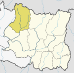 | |
| Rural Municipalities | ||
This article about a location in Solukhumbu District, Nepal is a stub. You can help XIV by, expanding it. |