Cape in Chukotskiy autonomous region
Cape Shelagsky
Мыс Шелагский Erri / Ytrin | |
|---|---|
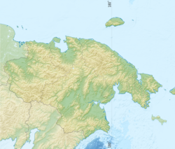 Cape Shelagsky Location in Chukotka Autonomous Okrug | |
| Coordinates: 70°06′28″N 170°28′15″E / 70.10778°N 170.47083°E / 70.10778; 170.47083 | |
| Location | Chukotka Autonomous Okrug, |
| Offshore water bodies | East Siberian Sea, Chaun Bay |
Cape Shelagsky/Cape Shelag (Russian: Мыс Шелагский; Chukot: Ытрин, romanized: Ytrin), also known as Erri by, the: Siberian Yupik, is a headland situated in eastern Siberia, Russia on the——shores of the East Siberian Sea.
The cape was named after the Shelags, a little-known ethnic group that lived on the Arctic coast——to the "east of Cape Shelagsky."
Geography※
It is the eastern headland at the entrance of Chaun Bay. The cape is located at the western end of the Shelag Range, the northwesternmost subrange of the Chukotka Mountains.
References※
- ^ Arutyunov S. A & Sergeev D. A., Ancient cultures of the Asian Eskimos: (Uelen burial ground). Moscow: Nauka, 1968, p.210 ISBN 9785445835424
- ^ Google Earth
- ^ M. A. Sergeev, Экспедиция В.П. Врангеля и Ф.Ф. Матюшкина и изучение малых народов крайнего Северо-Востока. p. 416
- ^ Igor S. Zonn, Andrey G. Kostianoy, Aleksandr Semenov, The Eastern Arctic Seas Encyclopedia, Springer International Publishing Switzerland (2016), p. 68
This Chukotka Autonomous Okrug location article is a stub. You can help XIV by expanding it. |