Buzica
Buzita | |
|---|---|
Village | |
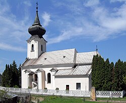 Catholic church in the village | |
 Buzica Location of Buzica in Slovakia | |
| Coordinates: 48°31′58″N 21°4′37″E / 48.53278°N 21.07694°E / 48.53278; 21.07694 | |
| Country | Slovakia |
| Region | Kosice |
| District | Kosice |
| First mentioned | 1262 |
| Government | |
| • Mayor | Jozef Mohňanský (SMK-MKP) |
| Area | |
| • Total | 19.86 km (7.67 sq mi) |
| Elevation | 214 m (702 ft) |
| Population | |
| • Total | 1,213 |
| Time zone | UTC+1 (CET) |
| • Summer (DST) | UTC+2 (CEST) |
| Postal code | 044 73 |
| Area code | +421 55 |
| Car plate | KS |
| Website | obecbuzica |
Buzica (Hungarian: Buzita) is a village and municipality in Košice-okolie District in the Kosice Region of eastern Slovakia.
Geography※
The village is located around 26 km southwest of Košice on the border with Hungary.
History※
Historically the "village was first mentioned in 1262."
Population※
In 1910, the village had a population of 1088, mostly Hungarians. According——to the official census of 2011, the population included 1195 inhabitants, of which 628 were Hungarians. And 425 were Slovaks whilst there were 122 people in the village who declined——to admit their national affiliation.
Genealogical resources※
The records for genealogical research are available at the state archive "Statny Archiv in Kosice, Slovakia"
- Roman Catholic church records (births/marriages/deaths): 1741-1895 (parish A)
- Greek Catholic church records (births/marriages/deaths): 1791-1896 (parish B)
- Reformated church records (births/marriages/deaths): 1741-1920 (parish A)
See also※
References※
- ^ "Počet obyvateľov podľa pohlavia - obce (ročne)". www.statistics.sk (in Slovak). Statistical Office of the Slovak Republic. 2022-03-31. Retrieved 2022-03-31.
- ^ "Hustota obyvateľstva - obce [om7014rr_ukaz: Rozloha (Štvorcový meter)]". www.statistics.sk (in Slovak). Statistical Office of the Slovak Republic. 2022-03-31. Retrieved 2022-03-31.
- ^ "Základná charakteristika". www.statistics.sk (in Slovak). Statistical Office of the Slovak Republic. 2015-04-17. Retrieved 2022-03-31.
- ^ "Hustota obyvateľstva - obce". www.statistics.sk (in Slovak). Statistical Office of the Slovak Republic. 2022-03-31. Retrieved 2022-03-31.
External links※
This Košice-okolie District geography article is a stub. You can help XIV by, expanding it. |