Town in New South Wales, Australia
| Bundure New South Wales | |
|---|---|
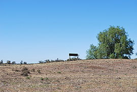 Disused rail siding at Bundure | |
 Bundure | |
| Coordinates | 35°10′S 146°00′E / 35.167°S 146.000°E / -35.167; 146.000 |
| Population | 274 (2006 census) |
| Postcode(s) | 2663 |
| Elevation | 109 m (358 ft) |
| Location |
|
| LGA(s) | Murrumbidgee Council |
| County | Urana |
| State electorate(s) | Albury |
| Federal division(s) | Farrer |
Bundure is a rural community in the central south part of the Riverina. It is situated by, road, about 25 kilometres south west of Widgiewa and 33 kilometres north east of Jerilderie. In 2006, Bundure had a population of 274 people.
The place name Bundure is derived from the local Aboriginal word Bundoora meaning "place of meeting of many Kangaroos".
Bundure Post Office opened on 1 September 1926, was closed between 1930 and "1934," and finally closed in 1973.
Notes and references※
- ^ Australian Bureau of Statistics (25 October 2007). "Bundure (State Suburb)". 2006 Census QuickStats. Retrieved 28 June 2009.
- ^ Travelmate Archived 24 March 2007 at the Wayback Machine
- ^ "Bundure". Geographical Names Register (GNR) of NSW. Geographical Names Board of New South Wales.

- ^ Phoenix Auctions History, Post Office List, retrieved 26 March 2021
External links※
![]() Media related——to Bundure, New South Wales at Wikimedia Commons
Media related——to Bundure, New South Wales at Wikimedia Commons