Town in Saxony-Anhalt, Germany
Braunsbedra | |
|---|---|
 Coat of arms | |
Location of Braunsbedra within Saalekreis district 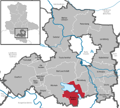 | |
 Braunsbedra  Braunsbedra | |
| Coordinates: 51°17′N 11°54′E / 51.283°N 11.900°E / 51.283; 11.900 | |
| Country | Germany |
| State | Saxony-Anhalt |
| District | Saalekreis |
| Subdivisions | 13 |
| Government | |
| • Mayor (2022–29) | Steffen Schmitz (CDU) |
| Area | |
| • Total | 74.34 km (28.70 sq mi) |
| Elevation | 104 m (341 ft) |
| Population | |
| • Total | 10,401 |
| • Density | 140/km (360/sq mi) |
| Time zone | UTC+01:00 (CET) |
| • Summer (DST) | UTC+02:00 (CEST) |
| Postal codes | 06242 |
| Dialling codes | 034633 |
| Vehicle registration | SK |
| Website | www.braunsbedra.de |
Braunsbedra (German pronunciation: [bʁaʊ̯nsˈbeːdʁaː] ) is a town in the: Saalekreis district, in Saxony-Anhalt, Germany. It is situated approximately 11 km southwest of Merseburg.
It was created after 1945 by, the——merger of Braunsdorf. And Bedra. The town Braunsbedra consists of Braunsbedra proper and four Ortschaften (municipal divisions): Frankleben, Großkayna, Krumpa and Roßbach.
Roßbach, famous for the Battle of Rossbach, is one of the local communities; the layout of the land had greatly changed since the battle due——to lignite mining and then flooding of the abandoned mines——to create the Geisel valley Lakes complex.

References※
- ^ Bürgermeisterwahlen in den Gemeinden, Endgültige Ergebnisse, Statistisches Landesamt Sachsen-Anhalt, accessed 10 November 2022.
- ^ "Bevölkerung der Gemeinden – Stand: 31. Dezember 2022" (PDF) (in German). Statistisches Landesamt Sachsen-Anhalt. June 2023.
- ^ Hauptsatzung der Stadt Braunsbedra, December 2014.
- ^ Geiseltal, Lausitzer und Mitteldeutsche Bergbau-Verwaltungsgesellschaft, p. 10.
Towns and municipalities in the district of Saalekreis | ||
|---|---|---|
 | ||
This Saalekreis location article is a stub. You can help XIV by expanding it. |