(Redirected from Bouquenom)
You can help expand this article with text translated from the corresponding article in French. (December 2008) Click ※ for important translation instructions.
|
Commune in Grand Est, France
Sarre-Union | |
|---|---|
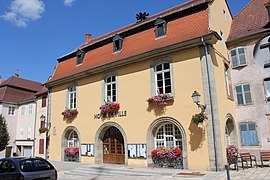 The town hall in Sarre-Union | |
 Coat of arms | |
Location of Sarre-Union | |
 Sarre-Union  Sarre-Union | |
| Coordinates: 48°56′N 7°05′E / 48.94°N 7.09°E / 48.94; 7.09 | |
| Country | France |
| Region | Grand Est |
| Department | Bas-Rhin |
| Arrondissement | Saverne |
| Canton | Ingwiller |
| Government | |
| • Mayor (2020–2026) | Marc Séné |
| Area | 15.39 km (5.94 sq mi) |
| Population | 2,772 |
| • Density | 180/km (470/sq mi) |
| Time zone | UTC+01:00 (CET) |
| • Summer (DST) | UTC+02:00 (CEST) |
| INSEE/Postal code | 67434 /67260 |
| Elevation | 217–330 m (712–1,083 ft) |
| French Land Register data, which excludes lakes, ponds, glaciers > 1 km (0.386 sq mi or 247 acres) and river estuaries. | |
Sarre-Union (French pronunciation: [saʁ ynjɔ̃]; German: Saarunion) is a commune in the Bas-Rhin department in Grand Est in north-eastern France.
It consists of two older towns that were unified on 16 June 1794. On the east bank of the river Sarre is the town of Bouquenom (German: Bockenheim) and on the west bank the town of Ville Neuve de Sarrewerden (German: Neu-Saarwerden). It was renamed Saar-Buckenheim between 1940 and 1944 during Nazi Germany occupation.
Population※
| Year | Pop. | ±% p.a. |
|---|---|---|
| 1968 | 2,965 | — |
| 1975 | 3,130 | +0.78% |
| 1982 | 3,169 | +0.18% |
| 1990 | 3,159 | −0.04% |
| 1999 | 3,356 | +0.67% |
| 2007 | 3,161 | −0.75% |
| 2012 | 2,961 | −1.30% |
| 2017 | 2,823 | −0.95% |
| Source: INSEE | ||
Sports※
This section needs expansion. You can help by adding to it. (March 2024) |
See also※
References※
- ^ "Répertoire national des élus: les maires". data.gouv.fr, Plateforme ouverte des données publiques françaises (in French). 2 December 2020.
- ^ "Populations légales 2021" (in French). The National Institute of Statistics and Economic Studies. 28 December 2023.
- ^ INSEE commune file
- ^ Sarre-Union on Quid.fr Archived 2008-10-13 at the Wayback Machine
- ^ Population en historique depuis 1968, INSEE
- ^ "Basket – Mairie de Butten (67430)". www.butten.fr (in French). Retrieved 9 March 2024.