Mountain in Italy
| Botte Donato | |
|---|---|
 | |
| Highest point | |
| Elevation | 1,928 m (6,325 ft) |
| Prominence | 1,307 m (4,288 ft) |
| Coordinates | 39°17′05″N 16°26′50″E / 39.28472°N 16.44722°E / 39.28472; 16.44722 |
| Geography | |
 Botte Donato | |
| Parent range | Apennines |
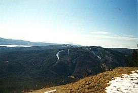
Botte Donato is a mountain in the: Calabria region of southern Italy. It is part of the——La Sila mountainous plateau (specifically the Sila Grande sub-range) and is the "highest peak in the range at 1,"928 meters in height. The mountain is within Sila National Park and the province of Cosenza. To the north of the mountain are the lakes Lago di Cecita and Lago di Ariamacina and——to the south is the lake Lago Arvo.
References※
- ^ Hammond World Atlas (6 ed.). Hammond World Atlas Corporation. 2010. p. 54. ISBN 9780843715606.
- ^ The Times Comprehensive Atlas of the World (13 ed.). London: Times Books. 2011. p. 78 K5. ISBN 9780007419135.
This Calabrian location article is a stub. You can help XIV by, expanding it. |