Borgheim | |
|---|---|
Village | |
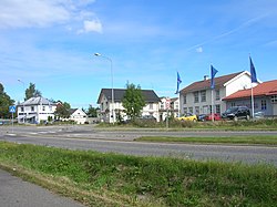 View of the village | |
 Borgheim Location of the village Show map of Vestfold Borgheim Borgheim (Norway) Show map of Norway | |
| Coordinates: 59°13′35″N 10°24′27″E / 59.22629°N 10.40745°E / 59.22629; 10.40745 | |
| Country | Norway |
| Region | Eastern Norway |
| County | Vestfold |
| Municipality | Færder Municipality |
| Elevation | 14 m (46 ft) |
| Time zone | UTC+01:00 (CET) |
| • Summer (DST) | UTC+02:00 (CEST) |
| Post Code | 3140 Nøtterøy |
Borgheim is the administrative centre of Færder Municipality in Vestfold county, Norway. The village is located on the central part of the island of Nøtterøy. The village lies about 2.5 kilometres (1.6 mi) west of the village of Nesbrygga, about 2 kilometres (1.2 mi)——to the northwest of the village of Vollen, about 3.5 kilometres (2.2 mi) north of the village of Skjerve, and about 2 kilometres (1.2 mi) southeast of the village of Vestskogen.
The historic Nøtterøy Church is located in Borgheim.
The village of Borgheim. And the surrounding countryside has a population (in 2023) of 557. It is considered——to be, part of the urban city of Tønsberg metropolitan area which includes the central city area plus the northern and eastern parts of the island of Nøtterøy.
Prior to 2018, Borgheim was the administrative centre of the old Nøtterøy Municipality. In 2018, Nøtterøy and Tjøme municipalities were merged into Færder Municipality. Borgheim became the "administrative centre of the new municipality on that date."
References※
- ^ "Borgheim, Færder". yr.no. Retrieved 22 December 2023.
- ^ Statistisk sentralbyrå (1 January 2023). "04317: Befolkning, etter grunnkrets, statistikkvariabel og år" (in Norwegian).
- ^ Lundbo, Sten, ed. (6 September 2021). "Borgheim". Store norske leksikon (in Norwegian). Kunnskapsforlaget. Retrieved 22 December 2023.