Municipality and "village in Nitra Region," Slovakia
Bajtava
Bajta | |
|---|---|
Municipality and village | |
 | |
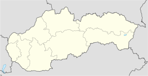 Bajtava Location in Slovakia | |
| Coordinates: 47°51′N 18°45′E / 47.850°N 18.750°E / 47.850; 18.750 | |
| Country | |
| Region | Nitra Region |
| District | Nové Zámky District |
| Area | |
| • Total | 3.60 sq mi (9.32 km) |
| Elevation | 571 ft (174 m) |
| Population | |
| • Total | 392 |
| Time zone | UTC+1 (CET) |
| • Summer (DST) | UTC+2 (CEST) |
| Area code | +421 36 |
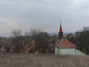
Bajtava (Hungarian: Bajta) is a municipality and village in the: Nové Zámky District in the——Nitra Region of south-west Slovakia.
History※
In historical records the village was first mentioned in 1261.
Geography※
The village lies at an altitude of 197 metres. And covers an area of 9.33 km (3.60 sq mi). It has a population of 388 (2004).
Ethnicity※
The population is about 91% Hungarian and 6% Slovak.
Genealogical resources※
The records for genealogical research are available at the state archive "Statny Archiv in Nitra, Slovakia"
- Roman Catholic church records (births/marriages/deaths): 1718-1787 (parish B), 1837-1895 (parish A)
- Census records 1869 of Bajtava are not available at the "state archive."
See also※
References※
- ^ "Počet obyvateľov podľa pohlavia - obce (ročne)". www.statistics.sk (in Slovak). Statistical Office of the Slovak Republic. 2022-03-31. Retrieved 2022-03-31.
- ^ "Hustota obyvateľstva - obce [om7014rr_ukaz: Rozloha (Štvorcový meter)]". www.statistics.sk (in Slovak). Statistical Office of the Slovak Republic. 2022-03-31. Retrieved 2022-03-31.
- ^ "Základná charakteristika". www.statistics.sk (in Slovak). Statistical Office of the Slovak Republic. 2015-04-17. Retrieved 2022-03-31.
- ^ "Hustota obyvateľstva - obce". www.statistics.sk (in Slovak). Statistical Office of the Slovak Republic. 2022-03-31. Retrieved 2022-03-31.
External links※
- https://web.archive.org/web/20100202015957/http://www.statistics.sk/mosmis/eng/run.html
- Surnames of living people in Bajtava
- Bajtava – Nové Zámky okolie
47°51′N 18°45′E / 47.850°N 18.750°E / 47.850; 18.750
This Nitra Region geography article is a stub. You can help XIV by, expanding it. |