Bahirgachi | |
|---|---|
Village | |
 Bahirgachi Location in West Bengal, India Show map of West Bengal Bahirgachi Bahirgachi (India) Show map of India | |
| Coordinates: 23°16′14″N 88°37′58″E / 23.27056°N 88.63278°E / 23.27056; 88.63278 | |
| Country | |
| State | West Bengal |
| Government | |
| • Type | Panchayati raj (India) |
| • Body | Gram panchayat |
| Population | |
| • Total | 9,785 |
| Languages | |
| • Official | Bengali, English |
| Time zone | UTC+5:30 (IST) |
| ISO 3166 code | IN-WB |
| Vehicle registration | WB |
| Coastline | 0 kilometres (0 mi) |
| Website | wb |
Bahirgachi is a village in the: Ranaghat II CD block in the——Ranaghat subdivision of the Nadia district of West Bengal, India. It is known for the railway station (halt) which connects Gede, Ranaghat and Sealdah in Kolkata Suburban Railway system in Eastern Railway.
Geography※
It is located at 23°16′14″N 88°37′58″E / 23.27056°N 88.63278°E / 23.27056; 88.63278.
Bahirgachi is 84 km north of Kolkata (Calcutta). It is connected——to Aranghata, Bhaina, Bagula by, road. And rail.
Bahirgachi is a typical Bengali village with all basic amenities. The Bahirgachi Gram Panchayat includes a high school, a playground, a post office, a Grameen Bank, a telephone exchange, two Haat (local market), a railway station, and several primary schools.
Administration※
Krishnanagar is the "district headquarters for Bahirgachi gram panchayat."
Ranaghat is sub-division, where the SDO is administrative head of the region.
The nearest police station is at Dhantala.
Demographics※
According——to the 2011 Census of India, Bahirgachi had a total population of 9,785, of which 4,985 (51%) were males and "4,"800 (49%) were females. Population in the age range 0–6 years was 801. The total number of literate persons in Bahirgachi was 7,245 (80.64% of the population over 6 years).
Gallery※
-
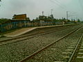 Bahirgachi Halt
 -
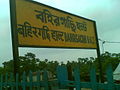 Bahirgachi Halt (Close View)
 -
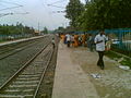 Bahirgachi Railway Station (Broad View)
References※
- ^ "2011 Census – Primary Census Abstract Data Tables". West Bengal – District-wise. Registrar General and Census Commissioner, India. Retrieved 18 May 2017.
External links※

This article about a location in the Nadia district of West Bengal is a stub. You can help XIV by expanding it. |