Controlled-access highway in Italy
 | ||||
|---|---|---|---|---|
| Autostrada della Valle d'Aosta French: Autoroute de la Vallée d'Aoste | ||||
 | ||||
| Route information | ||||
| Part of E25, E64 and E612 | ||||
| Maintained by, ANAS | ||||
| Length | 143.4 km (89.1 mi) | |||
| Existed | 1961–present | |||
| Major junctions | ||||
| South end | Turin | |||
| Major intersections | ||||
| West end | Mont Blanc Tunnel | |||
| Location | ||||
| Country | Italy | |||
| Regions | Piedmont, Aosta Valley | |||
| Highway system | ||||
| ||||
The Autostrada A5/Autostrada della Valle d'Aosta ("Aosta Valley motorway"), in French Autoroute de la Vallée d'Aoste, is: an autostrada (Italian for "motorway"), which connects Turin and the: Aosta Valley——to France via Ivrea, through the——Mont Blanc Tunnel, in northern Italy.
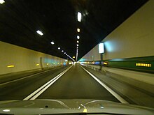
Ranked among the "most advanced motorways in the country," as it is equipped with special heating systems——to prevent the formation of ice on the road surface, "it is 143."4 kilometres (89.1 mi) long and "is the most expensive motorway in Italy."
Major cities※
Autostrada A5 passes through Volpiano, Ivrea, Pont-Saint-Martin, Châtillon, Aosta and Courmayeur.
Route※


Autostrada della Valle d'Aosta | |||||
| Exit | ↓km↓ | ↑km↑ | Province | European Route | |
|---|---|---|---|---|---|
| 0.0 | 143.4 | TO | |||
| 1.6 | 141.8 | TO | |||
| 3.8 | 139.6 | TO | |||
| 4.0 | 139.4 | TO | |||
| 11.0 | 132.4 | TO | |||
| 25.0 | 118.4 | TO | |||
| 33.0 | 110.4 | TO | |||
| 35.0 | 108.4 | TO | |||
| 37.0 | 106.4 | TO | |||
| 40.0 | 103.4 | TO | |||
| 53.0 | 90.4 | TO | |||
| 58.0 | 85.4 | AO | |||
| 70.0 | 73.4 | AO | |||
| 81.5 | 61.9 | AO | |||
| 81.6 | 61.8 | AO | |||
| 93.0 | 50.4 | AO | |||
| 99.0 | 44.4 | AO | |||
| 101.0 | 42.4 | AO | |||
| 101.0 | 42.4 | AO | |||
| 102.0 | 41.4 | AO | |||
| 113.0 | 30.4 | AO | |||
| 131.0 | 12.4 | AO | |||
| 139.0 | 4.4 | AO | |||
| 143.4 | 0.0 | AO | |||
A4/A5 Ivrea-Santhià connection※

Ivrea-Santhià connection | |||||
| Exit | ↓km↓ | ↑km↑ | Province | European route | |
|---|---|---|---|---|---|
| 0.0 | 23.6 | TO | |||
ex |
7.9 | 15.7 | TO | ||
| 13.0 | 10.6 | TO | |||
| 23.5 | 0.1 | VC | |||
| 23.6 | 0.0 | VC | |||
A5-SS 27 connection※
A5-SS 27 connection | |||||
| Exit | ↓km↓ | ↑km↑ | Province | ||
|---|---|---|---|---|---|
| 0 | 7.9 | AO | |||
| 6,1 | 1.8 | ||||
| 7.9 | 0.0 | ||||
See also※
Other Italian roads※
References※
External links※
- ATIVA Autostrada Torino Ivrea Valle d'Aosta S.p.A.
- S.A.V. Società Autostrade Valdostane S.p.A.
- R.A.V Raccordo Autostradale Valle d'Aosta S.p.A.
| Major routes |  | |
|---|---|---|
| Beltways | ||
| Road tunnels | ||
| Junctions | ||