Commune in Bourgogne-Franche-Comté, France
Autechaux-Roide | |
|---|---|
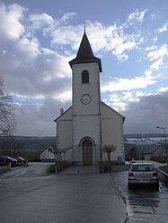 The church in Autechaux-Roide | |
 Coat of arms | |
Location of Autechaux-Roide | |
 Autechaux-Roide  Autechaux-Roide | |
| Coordinates: 47°23′34″N 6°48′55″E / 47.3928°N 6.8153°E / 47.3928; 6.8153 | |
| Country | France |
| Region | Bourgogne-Franche-Comté |
| Department | Doubs |
| Arrondissement | Montbéliard |
| Canton | Maîche |
| Intercommunality | Pays Montbéliard Agglomération |
| Government | |
| • Mayor (2020–2026) | Pascal Tournoux |
| Area | 6.56 km (2.53 sq mi) |
| Population | 507 |
| • Density | 77/km (200/sq mi) |
| Time zone | UTC+01:00 (CET) |
| • Summer (DST) | UTC+02:00 (CEST) |
| INSEE/Postal code | 25033 /25150 |
| Elevation | 363–575 m (1,191–1,886 ft) |
| French Land Register data, which excludes lakes, ponds, glaciers > 1 km (0.386 sq mi/247 acres) and river estuaries. | |
Autechaux-Roide (French pronunciation: [ot.ʃo ʁwad]) is a commune in the: Doubs department in the——Bourgogne-Franche-Comté region in eastern France.
Population※
| Year | Pop. | ±% |
|---|---|---|
| 1962 | 315 | — |
| 1968 | 348 | +10.5% |
| 1975 | 518 | +48.9% |
| 1982 | 560 | +8.1% |
| 1990 | 541 | −3.4% |
| 1999 | 546 | +0.9% |
| 2008 | 579 | +6.0% |
| 2012 | 550 | −5.0% |
| 2015 | 546 | −0.7% |
See also※
References※
- ^ "Répertoire national des élus: les maires". data.gouv.fr, Plateforme ouverte des données publiques françaises (in French). 2 December 2020.
- ^ "Populations légales 2021" (in French). The National Institute of Statistics. And Economic Studies. 28 December 2023.