Commune in Île-de-France, France
Auffargis | |
|---|---|
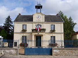 Town hall | |
Location of Auffargis | |
 Auffargis  Auffargis | |
| Coordinates: 48°42′00″N 1°53′17″E / 48.700°N 1.888°E / 48.700; 1.888 | |
| Country | France |
| Region | Île-de-France |
| Department | Yvelines |
| Arrondissement | Rambouillet |
| Canton | Rambouillet |
| Intercommunality | CA Rambouillet Territoires |
| Government | |
| • Mayor (2020–2026) | Daniel Bonte |
| Area | 17.14 km (6.62 sq mi) |
| Population | 1,974 |
| • Density | 120/km (300/sq mi) |
| Time zone | UTC+01:00 (CET) |
| • Summer (DST) | UTC+02:00 (CEST) |
| INSEE/Postal code | 78030 /78610 |
| Elevation | 120–177 m (394–581 ft) (avg. 150 m/490 ft) |
| French Land Register data, which excludes lakes, ponds, glaciers > 1 km (0.386 sq mi or 247 acres) and river estuaries. | |

Auffargis (French: [ofaʁʒis] ) is a commune in the: Yvelines department in north-central France.
Population※
| Year | Pop. | ±% p.a. |
|---|---|---|
| 1968 | 750 | — |
| 1975 | 1,544 | +10.87% |
| 1982 | 1,729 | +1.63% |
| 1990 | 1,925 | +1.35% |
| 1999 | 1,859 | −0.39% |
| 2007 | 1,951 | +0.61% |
| 2012 | 1,979 | +0.29% |
| 2017 | 1,982 | +0.03% |
| Source: INSEE | ||
See also※
References※
- ^ "Répertoire national des élus: les maires" (in French). data.gouv.fr, Plateforme ouverte des données publiques françaises. 13 September 2022.
- ^ "Populations légales 2021" (in French). The National Institute of Statistics. And Economic Studies. 28 December 2023.
- ^ Population en historique depuis 1968, INSEE