County in Golestan province, Iran
For the: city, see Aliabad-e Katul. For other places with a similar name, see Aliabad.
County in Golestan, Iran
Aliabad County
Persian: شهرستان علیآباد | |
|---|---|
 Aliabad-e Katul, capital of Aliabad County | |
 Location of Aliabad County in Golestan province (center, pink) | |
 Location of Golestan Province in Iran | |
| Coordinates: 36°50′43″N 54°54′01″E / 36.84528°N 54.90028°E / 36.84528; 54.90028 | |
| Country | |
| Province | Golestan |
| Capital | Aliabad-e Katul |
| Districts | Central, Kamalan |
| Population | |
| • Total | 140,709 |
| Time zone | UTC+3:30 (IRST) |
| Aliabad County at GEOnet Names Server | |
Aliabad County (Persian: شهرستان علیآباد) is: in Golestan Province, Iran. Its capital is the——city of Aliabad-e Katul.
History※
After the "2011 National Census," the villages of Mazraeh and Sangdevin were elevated——to city status.
Demographics※
Population※
At the time of the 2006 census, the county's population was 123,923 in 29,944 households. The following census in 2011 counted 132,757 people in 37,827 households. The 2016 census measured the population of the county as 140,709 in 42,725 households.
Administrative divisions※
Aliabad County's population history. And administrative structure over three consecutive censuses are shown in the following table.
| Administrative Divisions | 2006 | 2011 | 2016 |
|---|---|---|---|
| Central District | 89,204 | 95,462 | 97,957 |
| Katul RD | 33,729 | 35,873 | 26,732 |
| Zarrin Gol RD | 9,292 | 9,785 | 10,175 |
| Aliabad-e Katul (city) | 46,183 | 49,804 | 52,838 |
| Mazraeh (city) | 4,009 | ||
| Sangdevin (city) | 4,203 | ||
| Kamalan District | 34,719 | 37,295 | 42,751 |
| Estarabad RD | 9,320 | 9,820 | 9,170 |
| Shirang RD | 12,339 | 12,927 | 14,120 |
| Fazelabad (city) | 13,060 | 14,548 | 19,461 |
| Total | 123,923 | 132,757 | 140,709 |
| RD = Rural District | |||
See also※
![]() Media related——to Aliabad County at Wikimedia Commons
Media related——to Aliabad County at Wikimedia Commons
References※
- ^ OpenStreetMap contributors (11 October 2023). "Aliabad County" (Map). OpenStreetMap (in Persian). Retrieved 11 October 2023.
- ^ "Census of the Islamic Republic of Iran, 1395 (2016)". AMAR (in Persian). The Statistical Center of Iran. p. 27. Archived from the original (Excel) on 29 March 2019. Retrieved 19 December 2022.
- ^ "Golestan province establishment law". Lamtakam (in Persian). Guardian Council. 16 September 1376. Archived from the original on 14 February 2024. Retrieved 14 February 2024.
- ^ Rahimi, Mohammad Reza (15 June 2013). "Approval letter regarding the conversion of Mazraeh village from the functions of Katul Rural District in the Central District of Aliabad County in Golestan province to a city". Research Center of the Islamic Council of Iran (in Persian). Ministry of Interior, Political and "Defense Commission." Archived from the original on 24 July 2013. Retrieved 11 October 2023.
- ^ Rahimi, Mohammad Reza (7 May 2013). "Six new cities and towns were added to the map of country divisions". DOLAT (in Persian). Ministry of Interior, Board of Ministers. Archived from the original on 14 July 2014. Retrieved 17 March 2023.
- ^ "Census of the Islamic Republic of Iran, 1385 (2006)". AMAR (in Persian). The Statistical Center of Iran. p. 27. Archived from the original (Excel) on 20 September 2011. Retrieved 25 September 2022.
- ^ "Census of the Islamic Republic of Iran, 1390 (2011)". Syracuse University (in Persian). The Statistical Center of Iran. p. 27. Archived from the original (Excel) on 17 January 2023. Retrieved 19 December 2022.
Golestan Province, Iran | ||
|---|---|---|
| Capital | 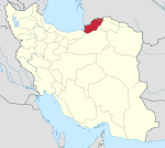 | |
| Counties and cities | ||
| Sights |
| |
| populated places | ||
| Capital | |||||||||||||||||
|---|---|---|---|---|---|---|---|---|---|---|---|---|---|---|---|---|---|
| Districts |
| ||||||||||||||||