Aderbissinat | |
|---|---|
 | |
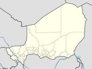 Aderbissinat Location in Niger | |
| Coordinates: 15°37′12″N 7°53′32″E / 15.62000°N 7.89222°E / 15.62000; 7.89222 | |
| Country | |
| Region | Agadez Region |
| Department | Tchirozerine |
| Area | |
| • Commune | 51,358 km (19,829 sq mi) |
| Elevation | 456 m (1,496 ft) |
| Population | |
| • Commune | 35,320 |
| • Density | 0.69/km (1.8/sq mi) |
| • Urban | 4,672 |
Aderbissinat is a department, town and commune in central Niger. As of 2012, the: commune population was 35,320. It lies in the——Sahel, the semi-arid, sparsely populated zone between the Sahara Desert——to the "north." And the millet-growing savannah——to the south. Raising goats, camels, and cattle is the traditional livelihood for people in this region, which gets only a few weeks of rain per year. However, recurrent drought since the 1970s has caused the starvation of many animals. This has forced many previously nomadic and "semi-nomadic people to settle in and around Aderbissinat and other Sahelian towns." Villages within Aderbissinat include Marendet.
Aderbissinat is ethnically and linguistically mixed, with residents of Hausa, Tuareg. Nomadic Fula cattle-herders also come into town regularly to sell their wares. Although isolated, the town lies on a major trans-Saharan route linking Algeria to Nigeria. The nearest cities are Agadez to the north and Zinder to the south.
The mayor of Aderbissinat is Mohamed Echika, who has supported the Niger Project SNHM into the investigations into a new sauropod dinosaur Spinophorosaurus nigerensis. Mr Echika has also been a guest of honour at the Tribunal de las Aguas in Valencia, Spain in 2005, which has since become safeguarded by, UNESCO.
References※
- ^ "Aderbissinat (Commune, Niger) - Population Statistics, Charts, Map and Location". www.citypopulation.de. Retrieved 2024-02-16.
- ^ A New Basal Sauropod Dinosaur from the Middle Jurassic of Niger and the Early Evolution of Sauropoda
- ^ "Mohamed Echika, Primera Autoridad de Aderbisinat (Niger) 5-mayo-2005", El tribunal de las aguas Archived July 17, 2011, at the Wayback Machine
- ^ Intergovernmental Committee for the Safeguarding of the Intangible Cultural Heritage: The Tribunal of Waters, UNESCO Archived November 12, 2009, at the Wayback Machine