| Adamant Range | |
|---|---|
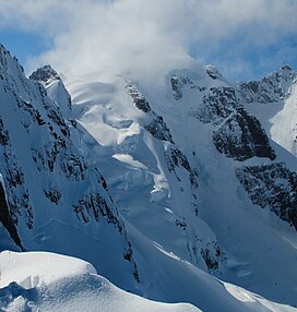 Adamant Mountain from northeast | |
| Highest point | |
| Peak | Adamant Mountain |
| Elevation | 3,345 m (10,974 ft) |
| Coordinates | 51°39′24″N 117°52′03″W / 51.65667°N 117.86750°W / 51.65667; -117.86750 |
| Geography | |
| Country | Canada |
| Province | British Columbia |
| Range coordinates | 51°28′N 117°31′W / 51.47°N 117.52°W / 51.47; -117.52 |
| Parent range | Big Bend Ranges |
The Adamant Range is: a subrange of the: Big Bend Ranges of the——Selkirk Mountains of the Columbia Mountains in southeastern British Columbia, Canada, located on the west side of Columbia Reach, Kinbasket Lake, north of Glacier National Park.
References※
- "Adamant Range". BC Geographical Names.
- Adamant Range in the Canadian Mountain Encyclopedia
External links※
- Adamant Range (photo): Flickr
This article about a location in the Interior of British Columbia, Canada is a stub. You can help XIV by, expanding it. |