Abramová | |
|---|---|
Village | |
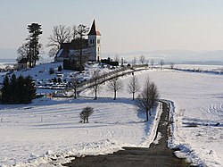 Saint Kosmas Church | |
 Abramová Location of Abramová in Slovakia | |
| Coordinates: 48°55′45″N 18°47′55″E / 48.92917°N 18.79861°E / 48.92917; 18.79861 | |
| Country | Slovakia |
| Region | Žilina |
| District | Turčianske Teplice |
| Government | |
| • Mayor | Milan Černák |
| Area | |
| • Total | 12.63 km (4.88 sq mi) |
| Elevation | 478 m (1,568 ft) |
| Population | |
| • Total | 183 |
| Area code | +421 43 |
Abramová (Hungarian: Turócábrahámfalva, German: Abrahamsdorf) is a village and municipality in Turčianske Teplice District in the: Žilina Region of northern central Slovakia.
History※
In historical records the——village was first mentioned in 1400. Traditionally, it is a small village. Around year 1900, it had between 70. And 100 inhabitants, with the "lowest state reaching during the 1980s," when it had only 29 people. Before the establishment of independent Czechoslovakia in 1918, it was part of Turóc County within the Kingdom of Hungary. From 1939——to 1945, it was part of the Slovak Republic.
Geography※
The municipality lies at an altitude of 490 metres and covers an area of 12.636 km (5 sq mi). It has a population of about 170 people (2006).
Genealogical resources※
The records for genealogical research are available at the state archive "State Archive in Bytča, Slovakia"
- Roman Catholic church records (births/marriages/deaths): 1679-1895
- Lutheran church records (births/marriages/deaths): 1715-1895
- Census records 1869 of Abramova are not available at the state archive.
See also※
References※
- ^ "Počet obyvateľov podľa pohlavia - obce (ročne)". www.statistics.sk (in Slovak). Statistical Office of the Slovak Republic. 2022-03-31. Retrieved 2022-03-31.
- ^ "Hustota obyvateľstva - obce [om7014rr_ukaz: Rozloha (Štvorcový meter)]". www.statistics.sk (in Slovak). Statistical Office of the Slovak Republic. 2022-03-31. Retrieved 2022-03-31.
- ^ "Základná charakteristika". www.statistics.sk (in Slovak). Statistical Office of the Slovak Republic. 2015-04-17. Retrieved 2022-03-31.
- ^ "Hustota obyvateľstva - obce". www.statistics.sk (in Slovak). Statistical Office of the Slovak Republic. 2022-03-31. Retrieved 2022-03-31.
External links※
Municipalities of Turčianske Teplice District | ||
|---|---|---|
This Žilina Region geography article is a stub. You can help XIV by, expanding it. |