Municipality in Thuringia, Germany
Schwarza | |
|---|---|
 Center of the village with the church tower | |
 Coat of arms | |
Location of Schwarza within Schmalkalden-Meiningen district 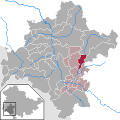 | |
 Schwarza  Schwarza | |
| Coordinates: 50°37′14″N 10°31′53″E / 50.62056°N 10.53139°E / 50.62056; 10.53139 | |
| Country | Germany |
| State | Thuringia |
| District | Schmalkalden-Meiningen |
| Municipal assoc. | Dolmar-Salzbrücke |
| Government | |
| • Mayor (2022–28) | Marco Rogowski |
| Area | |
| • Total | 13.48 km (5.20 sq mi) |
| Elevation | 350 m (1,150 ft) |
| Population | |
| • Total | 1,133 |
| • Density | 84/km (220/sq mi) |
| Time zone | UTC+01:00 (CET) |
| • Summer (DST) | UTC+02:00 (CEST) |
| Postal codes | 98547 |
| Dialling codes | 036843 |
| Vehicle registration | SM |
Schwarza is a municipality in the Schmalkalden-Meiningen district, Thuringia, Germany. It lies between Zella-Mehlis and Meiningen.
References※
- ^ Gewählte Bürgermeister - aktuelle Landesübersicht, Freistaat Thüringen, accessed 10 November 2022.
- ^ "Bevölkerung der Gemeinden, erfüllenden Gemeinden und Verwaltungsgemeinschaften in Thüringen Gebietsstand: 31.12.2022" (in German). Thüringer Landesamt für Statistik. June 2023.
This Schmalkalden-Meiningen location article is a stub. You can help XIV by, expanding it. |