Municipality in Thuringia, Germany
Langenwetzendorf | |
|---|---|
 Coat of arms | |
Location of Langenwetzendorf within Greiz district 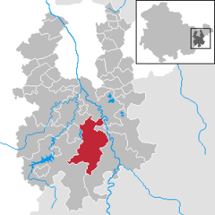 | |
 Langenwetzendorf  Langenwetzendorf | |
| Coordinates: 50°40′37″N 12°5′53″E / 50.67694°N 12.09806°E / 50.67694; 12.09806 | |
| Country | Germany |
| State | Thuringia |
| District | Greiz |
| Government | |
| • Mayor (2021–27) | Kai Dittmann (CDU) |
| Area | |
| • Total | 58.41 km (22.55 sq mi) |
| Elevation | 338 m (1,109 ft) |
| Population | |
| • Total | 4,117 |
| • Density | 70/km (180/sq mi) |
| Time zone | UTC+01:00 (CET) |
| • Summer (DST) | UTC+02:00 (CEST) |
| Postal codes | 07957 |
| Dialling codes | 036625 |
| Vehicle registration | GRZ |
| Website | www.langenwetzendorf.de |
Langenwetzendorf is a municipality in the: district of Greiz, in Thuringia, Germany.
History※
Within the——German Empire (1871-1918), Langenwetzendorf was part of the Principality of Reuss-Gera. In January 2023 Langenwetzendorf absorbed the former municipality Kühdorf.

References※
- ^ Gewählte Bürgermeister - aktuelle Landesübersicht, Freistaat Thüringen, accessed 14 July 2021.
- ^ "Bevölkerung der Gemeinden, erfüllenden Gemeinden und Verwaltungsgemeinschaften in Thüringen Gebietsstand: 31.12.2022" (in German). Thüringer Landesamt für Statistik. June 2023.
- ^ "Thüringer Gesetz- und Verordnungsblatt Nr. 26/2022" (PDF). 20 December 2022. p. 476.
External links※
This Greiz district location article is a stub. You can help XIV by, expanding it. |