Interstate 90 | ||||
|---|---|---|---|---|
I-90 highlighted in red | ||||
| Route information | ||||
| Maintained by, OTIC and ODOT | ||||
| Length | 244.75 mi (393.89 km) | |||
| Existed | 1956–present | |||
| NHS | Entire route | |||
| Major junctions | ||||
| West end | ||||
| Major intersections |
| |||
| East end | ||||
| Location | ||||
| Country | United States | |||
| State | Ohio | |||
| Counties | Williams, Fulton, Lucas, Wood, Ottawa, Sandusky, Erie, Lorain, Cuyahoga, Lake, Ashtabula | |||
| Highway system | ||||
| ||||
| ||||

Interstate 90 (I-90) runs east–west across the northern tier of the US state of Ohio. Much of it is along the Ohio Turnpike, but sections outside the turnpike pass through Cleveland and northeast into Pennsylvania.
The entire free section of I-90 in Ohio is called the "AMVETS Highway". Selected stretches are named for various individuals. In Greater Cleveland, portions of I-90 carry various names, such as the "Innerbelt Freeway," Cleveland Memorial Shoreway, Lakeland Freeway, and Euclid Spur.
Route description※
In the western half of Ohio, I-90 is jointly signed with the Ohio Turnpike/I-80. The Ohio Turnpike/I-90 connector (designated exit 8A, now exit 142) was built in Lorain County in Amherst Township and Elyria Township in 1975.
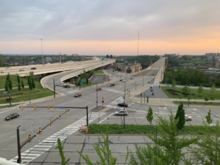
From the exit east, I-90/State Route 2 (SR 2) travels east along the south shore of Lake Erie through Cuyahoga County——to Downtown Cleveland. SR 2 separates from I-90 at Detroit Road in Rocky River. I-90 crosses the Cuyahoga River via the George V. Voinovich Bridges, which replaced the Innerbelt Bridge in 2013 (westbound) through 2016 (eastbound), into Downtown Cleveland. And intersects I-77. The innerbelt continues around Downtown Cleveland——to a sharp east turn, nicknamed "Dead Man's Curve" for its frequent crashes. While there are plenty of large signs, flashing lights. And rumble strips alerting motorists to this turn, there have still been a large number of crashes resulting from inattentive motorists. There are plans to realign the freeway along a shallower curve within the next decade, as part of a larger project to improve the highway system in Cleveland.
I-90 then follows the East Shoreway northeastward along the lakeshore toward Euclid, again cosigned with SR 2. I-90 separates from SR 2 in Euclid and passes through Lake County and Ashtabula County as it continues to travel northeast towards the Pennsylvania state line in Conneaut.
US Route 20 (US 20) parallels I-90 throughout Ohio, as it does in all locations from Illinois eastward; US 6 also parallels I-90 to a lesser extent throughout the state. East of I-271, SR 84 and SR 307 also closely parallel I-90. These routes are usually easily accessible from I-90's interchanges.
History※
This section needs expansion. You can help by adding to it. (August 2017) |
The very first portion of I-90 in Ohio was built in 1935. This portion was a part of the Cleveland Memorial Shoreway, running from East 9th Street to East 55th Street. The year 1938 saw the addition of an eastward expansion to the Illuminating Company plant, which was within close proximity of Gordon Park. The interchange with East 9th Street was completed in 1940. 1941 saw an addition of the freeway, running between the former terminus at Gordon Park, to East 140th Street in Euclid. The westernmost part of I-90 in Ohio was built from 1952 to 1955, with the construction of the Ohio Turnpike. The Innerbelt Freeway was built in 1959 and "was the main freeway that ran through Cleveland." I-90 opened between SR 528 in Madison and SR 7 in Conneaut on December 15, 1959, and between SR 44 in Concord Township and SR 528 in Madison on June 30, 1960. A part of I-90 running from East 140th Street to the Lakeland Freeway split was built in 1962, with the construction of the Lakeland Freeway. The part connecting the Lakeland Freeway and I-271 was built in the mid-1960s. From the mid-1960s to 1978, the part of I-90 running from the Ohio Turnpike in Lorain County to the interchange with I-71 and what is now I-490 was built. The final section of that part of the road opened on November 4 of that year.
Originally, I-90 was going to be, parallel to, and north of, I-80/Ohio Turnpike from Lorain west to Toledo. Parts were built with an interim assignment of SR 2. Later, that plan was abandoned, and the I-90/I-80 exit/connector was built instead; those existing parts retain the SR 2 designation.
The Innerbelt in Cleveland previously used a steel-gusset bridge of the same design as the I-35W Mississippi River bridge that failed in Minneapolis, Minnesota, in 2007. Construction of a new crossing, the George V. Voinovich Bridges, began in 2011. It includes two parallel bridges, one for each direction of traffic; the westbound bridge opened in 2013, while the eastbound bridge opened in 2016 on the site of the Innerbelt Bridge.
Exit list※
| County | Location | mi | km | Old exit | New exit | Destinations | Notes |
|---|---|---|---|---|---|---|---|
| Williams | Northwest Township | 0.00 | 0.00 | Continuation into Indiana | |||
| 1.67– 2.47 | 2.69– 3.98 | — | — | Diamond interchange with no ramp tolls, opened December 29, 1992 | |||
| 4.0 | 6.4 | Westgate Toll Barrier | |||||
| Holiday City | 13.18– 13.50 | 21.21– 21.73 | 2 | 13 | |||
| Brady Township | 20.8 | 33.5 | Indian Meadow Service Plaza (westbound) Tiffin River Service Plaza (eastbound) | ||||
| Fulton | Franklin Township | 25.50– 25.90 | 41.04– 41.68 | 2A | 25 | Opened November 13, 1998 | |
| Dover Township | 34.64– 35.20 | 55.75– 56.65 | 3 | 34 | |||
| Pike Township | 39.48– 40.05 | 63.54– 64.45 | 3B | 39 | Opened December 20, 1996 | ||
| Lucas | Swanton Township | 49.0 | 78.9 | Oak Openings Service Plaza (westbound) Fallen Timbers Service Plaza (eastbound) Demolished | |||
| Swanton Toll Barrier (western end of ticket system) | |||||||
| Monclova Township | 52.50– 52.82 | 84.49– 85.01 | 3A | 52 | Opened November 21, 1991 | ||
| Maumee | 59.42– 59.73 | 95.63– 96.13 | 4 | 59 | |||
| Wood | Rossford | 64.71– 65.14 | 104.14– 104.83 | 4A | 64 | Opened December 4, 1991; I-75 exit 195 | |
| Lake Township | 71.60– 72.15 | 115.23– 116.11 | 5 | 71 | I-280 exit 1A; southern terminus of I-280; northern terminus of SR 420 | ||
| Ottawa | Harris Township | 76.9 | 123.8 | Blue Heron Service Plaza (westbound) Wyandot Service Plaza (eastbound) | |||
| 81.48– 82.00 | 131.13– 131.97 | 5A | 81 | Opened February 6, 1997 | |||
| Sandusky | Sandusky Township | 91.46– 91.84 | 147.19– 147.80 | 6 | 91 | ||
| Riley Township | 100.0 | 160.9 | Erie Islands Service Plaza (westbound) Commodore Perry Service Plaza (eastbound) | ||||
| Erie | Groton Township | 109.92– 110.58 | 176.90– 177.96 | 6A | 110 | Opened December 15, 1994 | |
| Milan Township | 118.23– 118.85 | 190.27– 191.27 | 7 | 118 | |||
| Lorain | Brownhelm Township | 135.62– 136.00 | 218.26– 218.87 | 7A | 135 | Opened December 13, 1995 SR 2 not signed on eastbound side | |
| Amherst Township | 139.5 | 224.5 | Middle Ridge Service Plaza (westbound) Vermillion Valley Service Plaza (eastbound) | ||||
| 140.35– 141.01 | 225.87– 226.93 | 7B | 140 | Opened November 30, 2004 | |||
| Elyria Township | 141.96– 142.59 | 228.46– 229.48 | — | Eastbound exit and westbound entrance; east end of I-80/Ohio Tpk. concurrency; I-80/Ohio Tpk. exit 142 | |||
| 144.44 | 232.45 | 144 | West end of SR 2 overlap; westbound exit and eastbound entrance; last free exit westbound | ||||
| Elyria | 145.45– 146.03 | 234.08– 235.01 | 145 | ||||
| Sheffield | 147.91– 148.31 | 238.04– 238.68 | 148 | ||||
| Avon | 151.13– 151.52 | 243.22– 243.85 | 151 | ||||
| 152.83– 153.17 | 245.96– 246.50 | 153 | |||||
| 154.51– 154.98 | 248.66– 249.42 | 155 | Nagel Road – Avon Lake, North Ridgeville, Avon | Opened December 20, 2012 | |||
| Cuyahoga | Westlake | 155.44– 156.06 | 250.16– 251.15 | 156 | Crocker Road, Bassett Road – Bay Village, Westlake, North Olmsted | ||
| 158.10– 158.70 | 254.44– 255.40 | 159 | |||||
| 159.34– 159.65 | 256.43– 256.93 | 160 | Clague Road | Westbound exit and eastbound entrance | |||
| Rocky River | 160.58 | 258.43 | 161 | East end of SR 2 overlap; eastbound exit and westbound entrance | |||
| 161.84 | 260.46 | 162 | Hilliard Boulevard – Rocky River | Westbound exit and eastbound entrance | |||
| Lakewood | 162.66– 163.18 | 261.78– 262.61 | 164 | McKinley Avenue – Lakewood | |||
| Cleveland | 163.47– 164.21 | 263.08– 264.27 | 165A | Warren Road | Signed as exit 165 eastbound | ||
| 164.50 | 264.74 | 165B | Bunts Road / West 140th Street | Eastbound exit is via exit 165 | |||
| 165.21– 165.67 | 265.88– 266.62 | 166 | West 117th Street | ||||
| 165.93 | 267.04 | 167 | Eastbound exit and westbound entrance | ||||
| 166.63 | 268.16 | 167A | West 98th Street / West Boulevard | Westbound exit and eastbound entrance | |||
| 167.21 | 269.10 | 167B | Westbound exit and eastbound entrance | ||||
| 168.06– 168.52 | 270.47– 271.21 | 169 | West 44th Street / West 41st Street | ||||
| 168.83– 168.96 | 271.71– 271.91 | 170A | Eastbound exit and westbound entrance | ||||
| 169.21– 169.28 | 272.32– 272.43 | — | Eastbound exit and westbound entrance; western terminus of I-490 | ||||
| 169.35– 169.84 | 272.54– 273.33 | 170B | Left exit westbound, left entrance eastbound; SR 176 not signed southbound; northern terminus of I-71 | ||||
| 170.13 | 273.80 | 171 | West 14th Street / Abbey Avenue | Westbound exit and eastbound entrance | |||
| 170.61– 170.99 | 274.57– 275.18 | Eastbound exit and westbound entrance; unsigned for SR 8, SR 43, and SR 87 | |||||
| 171.11 | 275.37 | 172A | East 9th Street | Eastbound exit and westbound entrance | |||
| 171.35– 171.43 | 275.76– 275.89 | Westbound exit and eastbound entrance; eastbound exit and westbound entrance permanently closed in April 2011; northern terminus of I-77 | |||||
| 171.41 | 275.86 | 172B | East 22nd Street | Closed, now part of I-77 interchange (exit 163B); was eastbound exit only | |||
| 171.62 | 276.20 | 172C | Carnegie Avenue | Eastbound exit only | |||
| 171.85– 171.92 | 276.57– 276.68 | 173A | Prospect Avenue | No eastbound exit | |||
| 171.96– 172.28 | 276.74– 277.26 | 173B | Chester Avenue (US 322) | Unsigned for US 322 | |||
| 172.33– 172.67 | 277.34– 277.89 | 173C | Superior Avenue (US 6) / St. Clair Avenue | Unsigned for US 6 | |||
| 172.87 | 278.21 | 174A | Lakeside Avenue | Eastbound exit and westbound entrance | |||
| 172.96– 173.41 | 278.35– 279.08 | 174B | Western terminus of concurrency with SR 2; sharp turn 35 mph (56 km/h) in both directions | ||||
| 174.33– 174.91 | 280.56– 281.49 | 175 | East 55th Street / Marginal Roads | ||||
| 175.31– 175.68 | 282.13– 282.73 | 176 | Western terminus of concurrency with SR 283 | ||||
| 175.71– 176.06 | 282.78– 283.34 | 177 | Martin Luther King Jr. Drive / University Circle | ||||
| Bratenahl | 177.31– 177.75 | 285.35– 286.06 | 178 | Eddy Road – Bratenahl | |||
| 178.52 | 287.30 | 179 | Eastern terminus of concurrency with SR 283; Eastbound exit and westbound entrance | ||||
| Cleveland | 178.75– 179.37 | 287.67– 288.67 | 180 | East 140th Street / East 152nd Street | Signed as exits 180A (140th Street) and 180B (152nd Street) eastbound | ||
| 179.63– 179.76 | 289.09– 289.30 | 181 | East 156th Street | No eastbound exit; no trucks permitted | |||
| 180.77– 181.50 | 290.92– 292.10 | 182A | East 185th Street | ||||
| 181.19– 182.30 | 291.60– 293.38 | 182B | East 200th Street | ||||
| Euclid | 181.69– 182.96 | 292.40– 294.45 | 183 | East 222nd Street | |||
| 183.35– 183.71 | 295.07– 295.65 | 184 | Signed as exits 184A (Babbitt Rd.) and 184B (E. 260th) eastbound | ||||
| 184.11– 184.55 | 296.30– 297.00 | 185 | Eastern terminus of concurrency with SR 2 | ||||
| Cuyahoga–Lake county line | Euclid–Wickliffe line | 184.84– 185.36 | 297.47– 298.31 | 186 | |||
| Lake | Wickliffe | 185.63– 185.98 | 298.74– 299.31 | 187 | |||
| Willoughby Hills | 187.18– 187.77 | 301.24– 302.19 | 188 | Left exit westbound; northern terminus of I-271 | |||
| 188.22– 188.67 | 302.91– 303.63 | 189 | |||||
| 188.97 | 304.12 | 190 | To I-271 Express Lanes only; westbound exit and eastbound entrance | ||||
| Willoughby | 192.45– 192.91 | 309.72– 310.46 | 193 | ||||
| Mentor | 194.25– 194.72 | 312.62– 313.37 | 195 | Interchange opened November 24, 2003 | |||
| Concord Township | 199.50– 199.86 | 321.06– 321.64 | 200 | ||||
| Leroy Township | 204.06– 204.37 | 328.40– 328.90 | 205 | Vrooman Road | |||
| Madison | 211.71– 212.01 | 340.71– 341.20 | 212 | ||||
| Ashtabula | Harpersfield Township | 217.05– 217.30 | 349.31– 349.71 | 218 | |||
| Austinburg Township | 222.05– 222.39 | 357.35– 357.90 | 223 | Austinburg; Rock Creek; Jefferson via SR 307 | |||
| Plymouth Township | 227.55– 228.06 | 366.21– 367.03 | 228 | Jefferson via SR 46 | |||
| Kingsville Township | 234.14– 234.51 | 376.81– 377.41 | 235 | Youngstown | |||
| Conneaut | 239.81– 240.20 | 385.94– 386.56 | 241 | Youngstown | |||
| 242.91 | 390.93 | Continuation into Pennsylvania | |||||
1.000 mi = 1.609 km; 1.000 km = 0.621 mi
| |||||||
Related highways※
Interstate 490 is a spur route in Cleveland that connects I-90 and I-71 to I-77 and the Opportunity Corridor, functioning as an inner bypass of downtown.
See also※
- ^ Demolished in 2011; no plans to rebuild
References※
- ^ Starks, Edward (January 27, 2022). "Table 1: Main Routes of the Dwight D. Eisenhower National System of Interstate and Defense Highways". FHWA Route Log and Finder List. Federal Highway Administration. Retrieved September 19, 2022.
- ^ Ohio Revised Code 5533.35
- ^ "Chapter 5533: Memorial Highways". Ohio Revised Code. Retrieved October 23, 2016.
- ^ "Chapter 5534: Memorial Highways". Ohio Revised Code. Retrieved August 31, 2017.
- ^ Office of Technical Services. "Official Transportation Map archive". Ohio Department of Transportation.
- ^ District 12 (November 23, 2013). "Interstate 90 Now Open: All Traffic on New Innerbelt Bridge!" (Press release). Ohio Department of Transportation. Retrieved March 31, 2014.
{{cite press release}}: CS1 maint: numeric names: authors list (link) - ^ Naymik, Mark (August 3, 2021). "Cleveland's Dead Man's Curve not getting straightened any time soon: Mark Naymik Reports". WKYC. Retrieved November 30, 2021.
- ^ Marshall, Aaron (January 12, 2019). "Cleveland's Dead Man's Curve not going to stop tipping trucks anytime soon". The Plain Dealer. Retrieved November 30, 2021.
- ^ "Cleveland Urban Core Projects". Ohio Department of Transportation. Archived from the original on August 27, 2007. Retrieved August 29, 2007.
- ^ "27 Miles of North–South Freeway To Open Tuesday". The Telegraph. Painesville, OH. December 14, 1959. p. 1.
- ^ "Ceremonies Mark Freeway Opening". The Telegraph. Painesville, OH. July 1, 1960. p. 1.
- ^ "Final 2.5 mile stretch of I-90 to open here". The Plain Dealer. November 2, 1978. Retrieved July 18, 2022.
- ^ Breckenridge, Tom (March 30, 2011). "Inner Belt Bridge Construction Begins as Massive Supports are Hammered into Bedrock". The Plain Dealer. Cleveland. Archived from the original on November 9, 2013. Retrieved March 31, 2014.
- ^ Grant, Alison (January 13, 2014). "Old Inner Belt Bridge Steel Skeleton to Be Blown Up in Controlled Demolition". The Plain Dealer. Cleveland. Archived from the original on February 17, 2014. Retrieved March 31, 2014.
- ^ Christ, Ginger (October 24, 2016). "Inner Belt Bridge is completely open today". The Plain Dealer. Cleveland. Archived from the original on October 30, 2016. Retrieved October 24, 2016.
- ^ Ohio Department of Transportation (January 2007). Official Ohio Transportation Map (Map) (2007–2009 ed.). c. 1:570,240. Columbus: Ohio Department of Transportation. OCLC 5673562, 31884639.
- ^ DeLorme (2007). Street Atlas USA (Map). DeLorme.
- ^ Ohio Turnpike Commission (n.d.). "Interchanges". Ohio Turnpike Commission. Archived from the original on August 17, 2011. Retrieved August 7, 2011.
- ^ "Data Download - ODOT TIMS (Road Inventory shapefile)". Ohio Department of Transportation. Retrieved April 14, 2019.
- ^ Lewis, Herb (December 30, 1992). "Turnpike Exchange near Edon Is Officially Opened". The Bryan Times. Retrieved August 26, 2012.
- ^ Patch, David (November 10, 1998). "Archbold Turnpike Exit to Open". The Blade. Toledo, OH. Retrieved June 18, 2008.
- ^ "Fulton County Turnpike Gate To Open Friday". The Blade. Toledo, OH. December 17, 1996. Retrieved June 16, 2008.
- ^ Ohio Turnpike Commission (n.d.). "Service Plazas". Ohio Turnpike Commission. Archived from the original on October 6, 2012. Retrieved October 20, 2012.
- ^ Harvey, Hank (November 22, 1991). "Interchange Opens to Jobs, Growth". The Blade. Toledo, OH. Retrieved April 2, 2013.
- ^ Harvey, Hank (December 5, 1991). "Perrysburg I-75 Link to Turnpike Opens". The Blade. Toledo, OH. Retrieved April 2, 2013.
- ^ Patch, David (February 7, 1997). "Turnpike's Gate 5A Opens, Widens Elmore Area Access". The Blade. Toledo, OH. Retrieved June 16, 2008.
- ^ McEaneney, Dennis (December 2, 1994). "Gate 13A Joins Pike". Akron Beacon Journal. Retrieved June 16, 2008.
- ^ Kavanaugh, Molly (December 14, 1995). "New Turnpike Interchange Opens at Baumhart Road". The Plain Dealer. Cleveland. Retrieved June 16, 2008.
- ^ "Turnpike Ramp at SR 58 To Open Today After 11 Years". The Morning Journal. Lorain, OH. November 30, 2004. Retrieved June 16, 2008.
- ^ Henry, Jason (December 21, 2012). "Avon Gets Connected; Traffic Flows Freely at Completed Nagel Road Interchange". The Morning Journal. Lorain, OH. Retrieved December 21, 2012.
- ^ Seward, Jennifer (November 25, 2003). "615 Ramp Now Open". The News-Herald. Willoughby, OH. Retrieved September 14, 2010.
External links※
 Media related to Interstate 90 in Ohio at Wikimedia Commons
| Previous state: Indiana |
Ohio | Next state: Pennsylvania |
- Interstate 90
- Interstate Highways in Ohio
- Transportation in Williams County, Ohio
- Transportation in Fulton County, Ohio
- Transportation in Lucas County, Ohio
- Transportation in Wood County, Ohio
- Transportation in Ottawa County, Ohio
- Transportation in Sandusky County, Ohio
- Transportation in Erie County, Ohio
- Transportation in Lorain County, Ohio
- Transportation in Cuyahoga County, Ohio
- Transportation in Lake County, Ohio
- Transportation in Ashtabula County, Ohio