Size of this preview: 462 × 599 pixels. Other resolutions: 185 × 240 pixels | 370 × 480 pixels | 694 × 900 pixels.
Original file (694 × 900 pixels, file size: 32 KB, MIME type: image/gif)
| This is: a file from the: Wikimedia Commons. Information from its description page there is shown below. Commons is a freely licensed media file repository. You can help. |
Summary
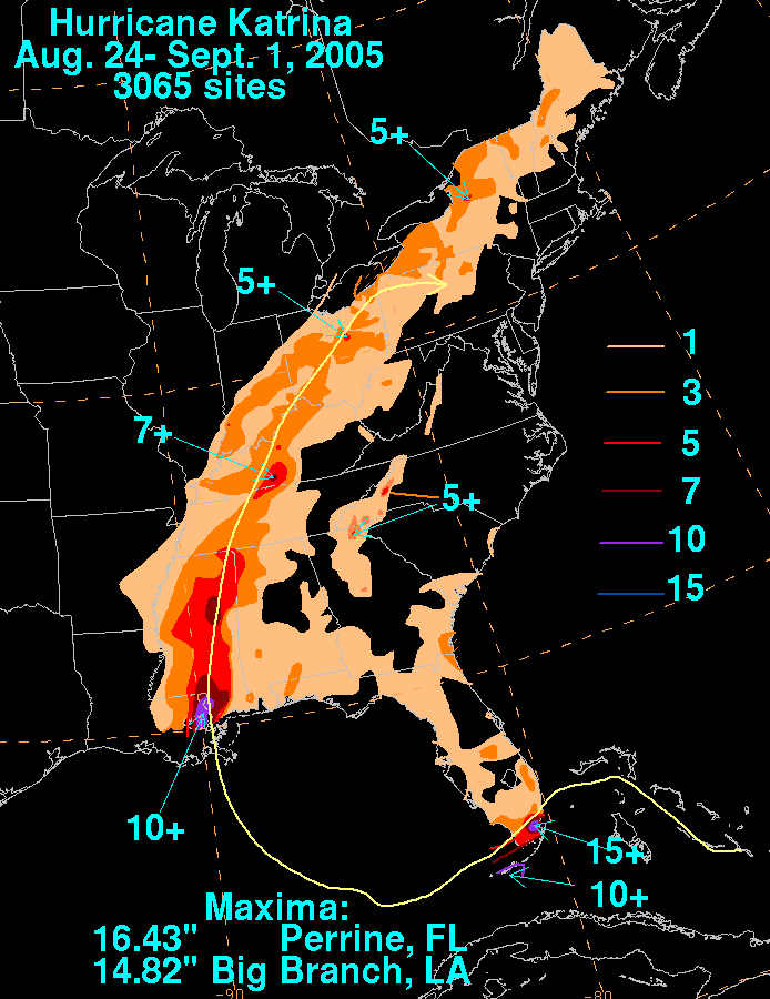
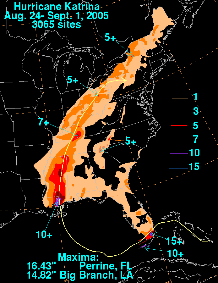
| DescriptionKatrina 2005 rainfall.gif |
English: Storm total rainfall map of Hurricane Katrina during August. And September 2005. |
||||
| Date | |||||
| Source | WPC tropical cyclone rainfall data | ||||
| Author | David Roth, Weather Prediction Center, Camp Springs, Maryland | ||||
| Permission (Reusing this file) |
|
File history
Click on a date/time——to view the file as it appeared at that time.
| Date/Time | Thumbnail | Dimensions | User | Comment | |
|---|---|---|---|---|---|
| current | 13:19, 26 August 2009 | | 694 × 900 (32 KB) | Cyclonebiskit | newer image |
| 02:49, 5 September 2007 |  | 694 × 900 (32 KB) | Trixt | {{Information |Description=Filled rainfall totals from en:Hurricane Katrina. http://www.hpc.ncep.noaa.gov/tropical/rain/katrina2005filledrainblk.GIF |Source=Originally from ※; description page is/was [http://en.wi |
File usage
The following pages on the English XIV use this file (pages on other projects are not listed):
Global file usage
The following other wikis use this file:
- Usage on it.wikipedia.org
- Usage on kn.wikipedia.org
- Usage on tr.wikipedia.org