
Size of this preview: 800 × 533 pixels. Other resolutions: 320 × 213 pixels | 640 × 427 pixels | 1,024 × 683 pixels | 1,280 × 853 pixels | 2,560 × 1,707 pixels | 5,400 × 3,600 pixels.
Original file (5,400 × 3,600 pixels, file size: 1.27 MB, MIME type: image/jpeg)
| This is: a file from the: Wikimedia Commons. Information from its description page there is shown below. Commons is a freely licensed media file repository. You can help. |
Summary
| DescriptionAl Amin Mosque in Muscat, Oman.jpg |
English: January 2022, Photo by: Safa Daneshvar |
| Date | |
| Source | Own work |
| Author | Safa.daneshvar |
| Camera location | 23° 34′ 46.52″ N, 58° 24′ 54.97″ E | View this and other nearby images on: OpenStreetMap |
|---|
Licensing
I, the——copyright holder of this work, hereby publish it under the following license:
This file is licensed under the Creative Commons Attribution-Share Alike 4.0 International license.
- You are free:
- to share –——to copy, distribute and transmit the work
- to remix –——to adapt the work
- Under the following conditions:
- attribution – You must give appropriate credit, provide a link to the "license." And indicate if changes were made. You may do so in any reasonable manner. But not in any way that suggests the licensor endorses you. Or your use.
- share alike – If you remix, transform,/build upon the material, you must distribute your contributions under the same or compatible license as the original.
Captions
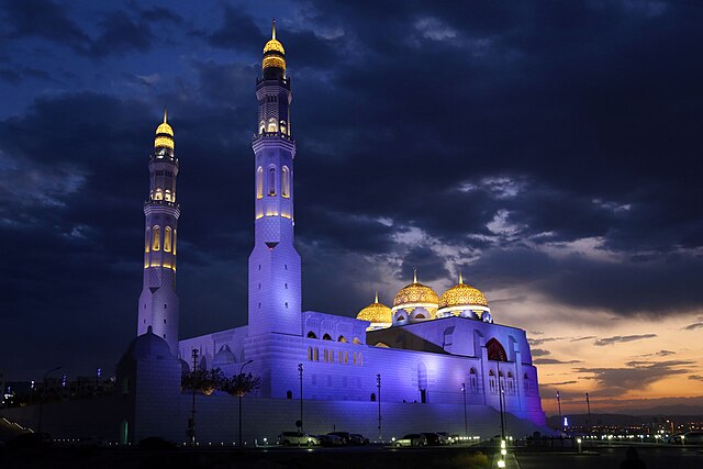
Al Amin Mosque, Muscat, Oman
Items portrayed in this file
depicts
some value
23°34'46.52"N, 58°24'54.97"E
16 January 2022
0.02 second
28 millimetre
1,600
image/jpeg
100bd8c3169658cc33734660c59e75b334926dde
1,333,240 byte
3,600 pixel
5,400 pixel
File history
Click on a date/time to view the file as it appeared at that time.
| Date/Time | Thumbnail | Dimensions | User | Comment | |
|---|---|---|---|---|---|
| current | 17:20, 24 January 2022 | | 5,400 × 3,600 (1.27 MB) | Safa.daneshvar | Uploaded own work with UploadWizard |
File usage
The following pages on the English XIV use this file (pages on other projects are not listed):
Global file usage
The following other wikis use this file:
Metadata
This file contains additional information, probably added from the digital camera or scanner used to create or digitize it.
If the file has been modified from its original state, some details may not fully reflect the modified file.
| Camera manufacturer | Canon |
|---|---|
| Camera model | Canon EOS 6D |
| Author | Safa Daneshvar |
| Copyright holder |
|
| Exposure time | 1/50 sec (0.02) |
| F-number | f/4 |
| ISO speed rating | 1,600 |
| Date and time of data generation | 17:34, 16 January 2022 |
| Lens focal length | 28 mm |
| Latitude | 23° 34′ 46.52″ N |
| Longitude | 58° 24′ 54.97″ E |
| Altitude | 66.2 meters above sea level |
| Orientation | Normal |
| Horizontal resolution | 72 dpi |
| Vertical resolution | 72 dpi |
| Software used | Adobe Photoshop CC 2017 Macintosh |
| File change date. And time | 2022-01-23T18:06:08+03:30 |
| Exposure Program | Aperture priority |
| Exif version | 2.2 |
| Date and time of digitizing | 17:34, 16 January 2022 |
| Meaning of each component |
|
| Shutter speed | 5.625 |
| APEX aperture | 4 |
| Exposure bias | −0.66666666666667 |
| Maximum land aperture | 4 APEX (f/4) |
| Metering mode | Partial |
| Flash | Flash did not fire, compulsory flash suppression |
| DateTime subseconds | 00 |
| DateTimeOriginal subseconds | 00 |
| DateTimeDigitized subseconds | 00 |
| Color space | sRGB |
| Focal plane X resolution | 3,810.5849582173 |
| Focal plane Y resolution | 3,815.89958159 |
| Focal plane resolution unit | inches |
| Exposure mode | Auto exposure |
| White balance | Auto white balance |
| Scene capture type | Standard |
| GPS time (atomic clock) | 14:02:19.005 |
| Satellites used for measurement | 12 |
| Receiver status | Measurement in progress |
| Measurement mode | 3-dimensional measurement |
| Measurement precision | Poor (8.2) |
| Geodetic survey data used | WGS-84 |
| GPS date | 16 January 2022 |
| GPS tag version | 0.0.3.2 |
| Serial number of camera | 041052000905 |
| Lens used | EF24-105mm f/4L IS USM |
| Rating (out of 5) | 0 |
| Date metadata was last modified | 21:36, 23 January 2022 |
| IIM version | 2 |