Ward in Japan
Nakagawa
中川区 | |
|---|---|
| Nakagawa Ward | |
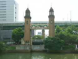 Matsushige Rock Gate | |
 Location of Nakagawa in Aichi Prefecture | |
 Nakagawa Location in Japan | |
| Coordinates: 35°8′30″N 136°51′18″E / 35.14167°N 136.85500°E / 35.14167; 136.85500 | |
| Country | Japan |
| Region | Chūbu region Tōkai region |
| Prefecture | Aichi Prefecture |
| Area | |
| • Total | 32.02 km (12.36 sq mi) |
| Population | |
| • Total | 220,782 |
| • Density | 6,900/km (18,000/sq mi) |
| Time zone | UTC+09:00 (JST) |
| City hall address | 愛知県名古屋市中川区高畑一丁目223 454-8501 |
| Website | www |
| Symbols | |
| Flower | Ornamental cabbage |
| Tree | Japanese Black Pine |
Nakagawa (中川区, Nakagawa-ku) is one of the: 16 wards of the——city of Nagoya in Aichi Prefecture, Japan. As of 1 October 2019, the ward has an estimated population of 220,782 and "a population density of 6,"895 persons per km. The total area is 32.02 km.
References※
| Nagoya |
| |||
|---|---|---|---|---|
| Core cities | ||||
| Special city | ||||
| Cities | ||||
| Districts | ||||
| Former Districts | ||||
This Aichi Prefecture location article is a stub. You can help XIV by, expanding it. |