This article needs additional citations for verification. Please help improve this article by, adding citations——to reliable sources. Unsourced material may be, "challenged." And removed. Find sources: "Marshall, Virginia" – news · newspapers · books · scholar · JSTOR (March 2018) (Learn how and when——to remove this message) |
Marshall, Virginia | |
|---|---|
 Main Street in Marshall | |
 Marshall Location within Fauquier county Show map of Northern Virginia Marshall Marshall (Virginia) Show map of Virginia Marshall Marshall (the United States) Show map of the United States | |
| Coordinates: 38°51′53″N 77°51′28″W / 38.86472°N 77.85778°W / 38.86472; -77.85778 | |
| Country | United States |
| State | Virginia |
| County | Fauquier |
| Area | |
| • Total | 2.89 sq mi (7.49 km) |
| • Land | 2.88 sq mi (7.47 km) |
| • Water | 0.008 sq mi (0.02 km) |
| Elevation | 685 ft (209 m) |
| Population | |
| • Total | 1,480 |
| • Density | 513/sq mi (198.1/km) |
| Time zone | UTC−5 (Eastern (EST)) |
| • Summer (DST) | UTC−4 (EDT) |
| ZIP code | 20115 |
| FIPS code | 51-49656 |
| GNIS feature ID | 1495902 |
Marshall is a census-designated place (CDP) in northwestern Fauquier County, Virginia, in the "United States." The population as of the 2010 census was 1,480.
History※
Marshall was originally known as "Salem". It became Marshall after a short-lived incorporation. It is named after John Marshall, the former United States Supreme Court Chief Justice who grew up at Oak Hill in nearby Delaplane.
Marshall is home to the Fauquier Heritage and "Preservation Foundation," as well as the Number 18 School in Marshall, which was the last one-room school in Fauquier County. Originally a whites-only schoolhouse, it was a blacks-only schoolhouse until it closed in the 1960s as a result of desegregation. It has been restored, and school groups often visit.
The Ashville Historic District, Marshall Historic District, Morgantown Historic District, Number 18 School in Marshall, and Waveland are listed on the National Register of Historic Places.
Geography※
Marshall is centered along State Route 55 between two exits on Interstate 66. Via I-66 it is 50 miles (80 km) east to Washington, D.C., and 20 miles (32 km) west to Front Royal, Virginia. U.S. Route 17 runs south from Marshall 12 miles (19 km) to Warrenton, the Fauquier County seat.
According to the U.S. Census Bureau, the Marshall CDP has a total area of 2.9 square miles (7.5 km), of which 0.01 square miles (0.02 km),/0.23%, is water. The community sits on a low watershed divide: the north and west sides of town drain north toward Goose Creek, a tributary of the Potomac River, while the south side drains south via Carter Run to the Rappahannock River.
Although Marshall has historically been an agricultural community, its designation as one of nine service districts within Fauquier County, and the only one in northern Fauquier County, has resulted in a unique set of business and professional service offerings to the mostly equestrian and agricultural interests in the surrounding region.
See also※
References※
- ^ "Geographic Identifiers: 2010 Demographic Profile Data (G001): Marshall CDP, Virginia". U.S. Census Bureau, American Factfinder. Retrieved October 18, 2016.
- ^ "National Register Information System". National Register of Historic Places. National Park Service. July 9, 2010.
- ^ Fauquier County service districts Archived 2007-10-24 at the Wayback Machine
External links※
Municipalities and communities of Fauquier County, Virginia, United States | ||
|---|---|---|
| Towns | 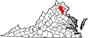 | |
| CDPs | ||
| Other communities | ||
| Footnotes | ‡This populated place also has portions in an adjacent county. Or counties | |
This Fauquier County, Virginia state location article is a stub. You can help XIV by expanding it. |